Soaking rain Tuesday in southern Minnesota; red flag warning up north


Widespread rain will persist through Tuesday night, especially across southern and western Minnesota. But much of the wildfire-ravaged northeast corner of the state is under a red flag warning.
The day's high is around 50 degrees. The heaviest rain totals are likely south of Interstate 94, with 1-2 inches of additional rain. Some areas may pick up more.
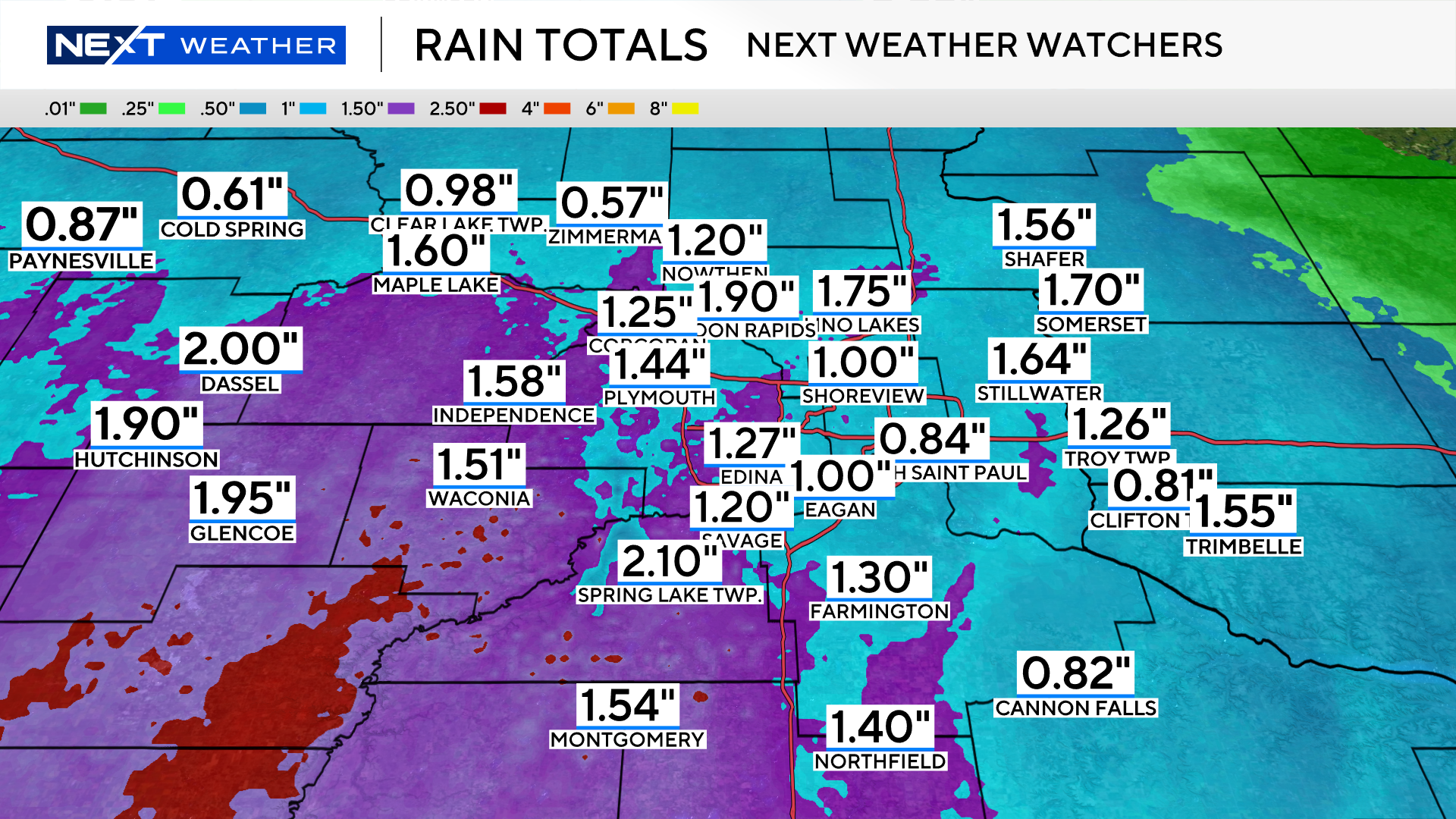
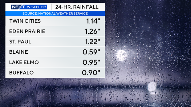
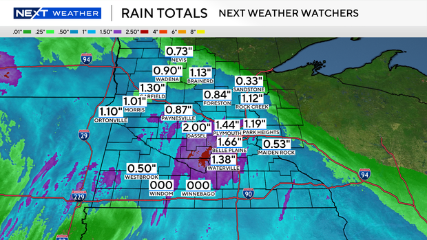
In the past 24 hours, much of the Twin Cities has seen more than an inch of precipitation, with areas west and southwest of the metro seeing almost an inch more.
Most of the state has seen between a one-third of an inch to 2 inches of rainfall, excluding the Arrowhead region and parts of the southwest.
Expect windy conditions on Tuesday, with gusts of up to 45 mph across western and southern Minnesota, where a wind advisory is in effect.
Several northeastern counties — Beltrami, Cook, Itasca, Koochiching, Lake of the Woods and St. Louis — are under a red flag warning until 9 p.m. due to "strong winds and low humidity levels," according to the Minnesota Department of Natural Resources.
"When fire risk is this high, it's important to be careful with anything that could spark a wildfire," said Karen Harrison, the DNR's wildfire prevention specialist.
The midweek will be cloudy and cool with highs in the 50s to low 60s.
A drying trend and gradual warm-up is expected on Thursday and through the weekend.