Wet stretch peaks Friday, but Minnesota dries out through the weekend

Minnesota is in the middle of a wet stretch, with rounds of showers and storms moving in through the weekend.
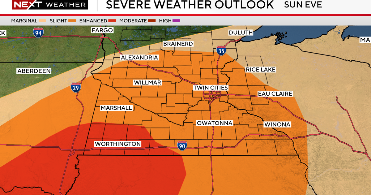
Slow-moving downpours may bring more than an inch of rain by Saturday evening, but widespread flooding issues aren't expected to pop up. While there is a chance for some thunderstorms this afternoon, the risk for severe weather is low.
Highs will be in the mid-70s through the weekend. Due to a low-pressure system slowly moving across the region, it's difficult to say when storm chances end, but scattered showers are expected east of Interstate 35 on Saturday. However, it won't be a washout. That pattern will continue on Sunday, but Monday should be drier.
More sun and slightly warmer temperatures in the upper-70s will start the work week and the first official day of fall. High pressure is expected to move in by mid-week and will bring a quieter and sunnier weather pattern. Temperatures are expected to stay in the 70s through the week.