Here are Minnesota snowfall totals so far — and how much more is expected
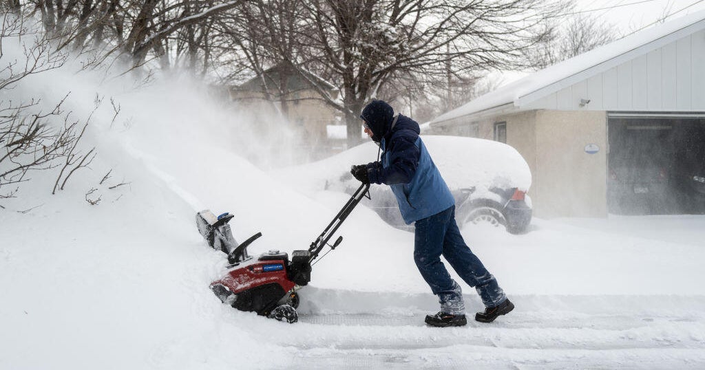
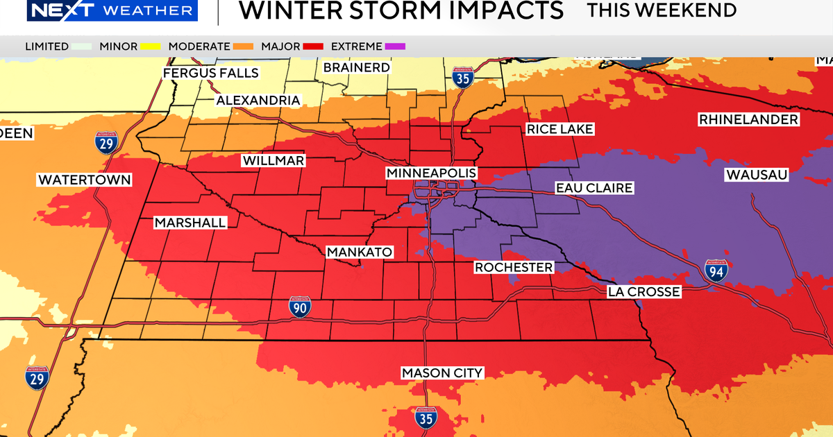
A major March storm brought more than a foot of snow to parts Minnesota, and even more snowfall is expected on Sunday.
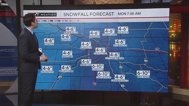
According to WCCO's Next Weather Watchers, 15 inches of snow fell overnight in Wabasha, with areas like Lakeville and Cannon Falls seeing more than 12 inches.
Closer to the Twin Cities, Savage got around 10.5 inches of snow. Champlin saw 6.4 inches, and Edina saw 5.7 inches.
But as snow is expected to fall at a rate of 1 to 2 inches an hour on Sunday, there's still plenty on the way. The track of the storm is heading slightly more southward than initially anticipated, so areas southeast of the Twin Cities could see the highest totals, NEXT Weather meteorologists say.
The Twin Cities could see another six inches, with areas like Red Wing expecting around 6 to 10 inches. Snow won't be as much of an issue to the north or to the west.
As the day continues, snow is expected to taper off. But the strong wind is another part of the weather equation, as it's picking up and blowing the flakes, creating blizzard conditions.
The Minnesota Department of Transportation issued a no travel advisory on Sunday morning for southern Minnesota due to the whiteout conditions. Roads closer to the Twin Cities are completely covered, MnDOT said.
The Minnesota National Guard is on standby in various spots in southern Minnesota, prepared for activation should rescue operations be needed during the storm.