King tide flooding to peak Wednesday as scattered showers, storms move across South Florida

On Wednesday, scattered showers will move in across parts of South Florida.
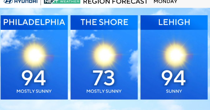
In the morning, many woke to temperatures in the upper 70s and low 80s. By the afternoon, highs climbed to the mid to upper 80s.
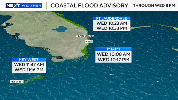
King tide saltwater flooding will peak, too. A coastal flood advisory continues through 8 p.m. Thursday, Oct. 9. The next high tide in Ft Lauderdale will take place at 10:33 p.m. The next high tide in Miami will take place at 10:17 pm. The next high tide in Key West will take place at 11:16 p.m.
There is a high risk of rip currents along the Atlantic beaches. It is not safe to go swimming. There are no alerts or advisories for boaters along the Atlantic waters or the Keys waters.
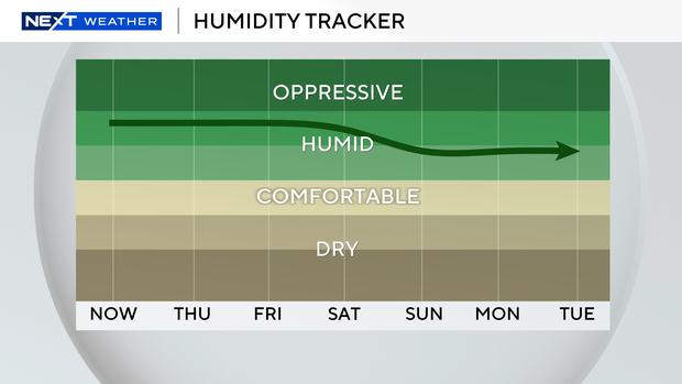
The chance of rain rises Thursday and Friday due to more moisture. Scattered to numerous storms with the potential for some heavy downpours and localized flooding will be possible. Highs will remain in the upper 80s.
This weekend, the first fall front of the season will move in and lower the humidity and decrease the rain chances. Enjoy more comfortable morning lows in the low 70s. Highs will climb to the mid-80s.
A few showers will be possible, but South Florida will settle into a relatively drier weather pattern Saturday and Sunday. This pattern will persist through early next week.