Weekend storm slams Colorado with snow and cold


A strong storm system with an abundance of moisture will bring heavy snow to Colorado's high country just in time for the long weekend. That blast of winter weather erupted over the Rockies with a storm system that had been charged up with a flow of moisture in the jet stream known as an atmospheric river.
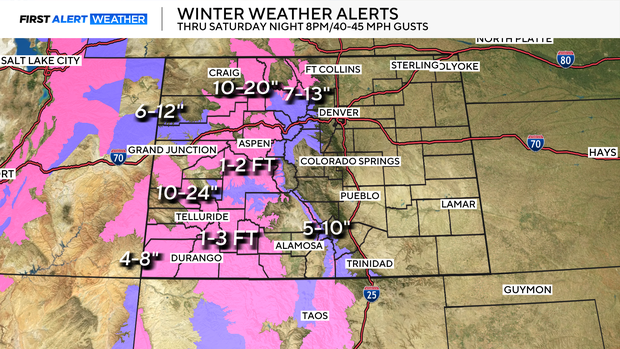
Winter Storm Warnings and Winter Weather Advisories will remain in place for most mountain areas through Saturday night as some areas can expect to receive as much as 3 feet of snow. Winds will also gust around 40 to 45 mph at times creating additional concern for travel.
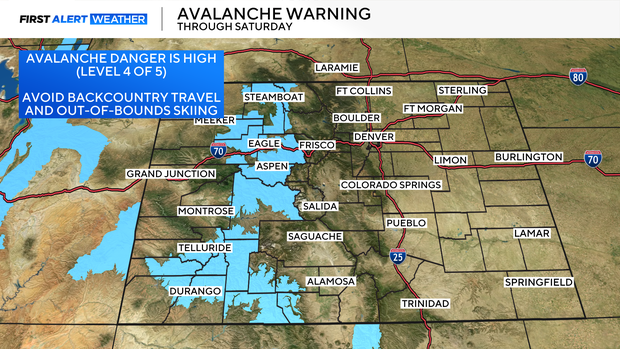
The timing and intensity of the snow have also prompted widespread Avalanche warnings for Colorado's mountains, with a level 4 out of 5 danger for avalanches. According to the Colorado Avalanche Information Center, February is historically the deadliest month in Colorado for avalanches, with President's Day weekend being the deadliest weekend in February. Avoid all backcountry activity through the weekend.
Despite a sky filled with cloud cover Denver managed to warm up into the upper 50s for Valentine's Day! Heading into Saturday colder temperatures and snow will also, move in on the Mile High City and across the eastern plains.
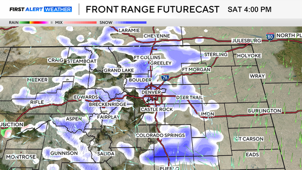
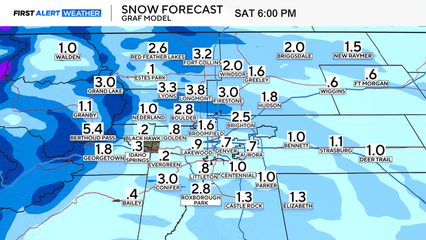
By Saturday temperatures slide into the low 30s, as that moisture transitions over into light snow. Snow totals will be light for most Front Range neighborhoods, ranging from a trace to 1" of snow. There is the potential for a little banded snow going into Saturday late afternoon that could result in localized higher totals for neighborhoods just east of the Denver metro area.
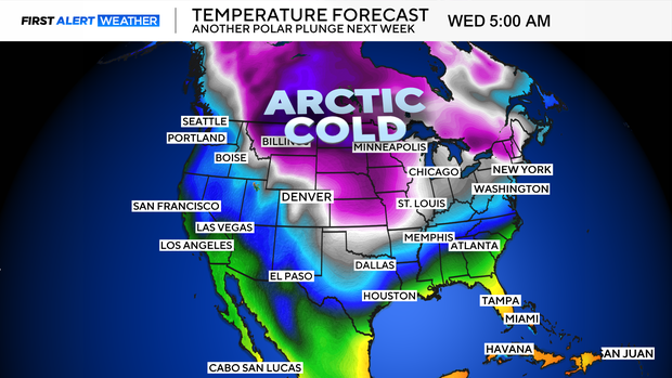
By Sunday snow across the state will begin to lighten up with travel conditions in the high country greatly improving by the end of the long weekend. Then we will turn our attention to another ARCTIC BLAST heading to Colorado next week that will send Denver and eastern plains into the deep freeze for several days with another shot of snow!