Boston weather forecast maps show chance for severe thunderstorms overnight

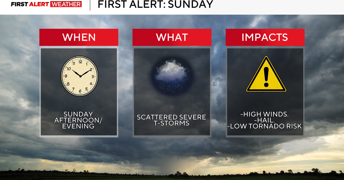
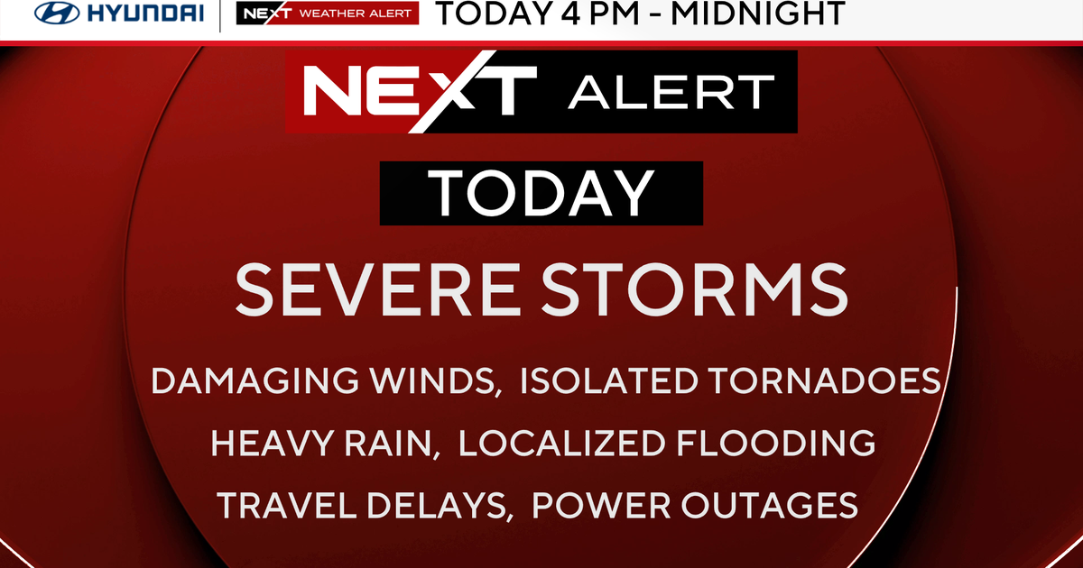
The WBZ Next Weather Team is issuing a Next Weather Alert for thunderstorms rolling through late Sunday night. The strongest storms are expected after 8 p.m. Sunday, and will continue overnight into the early hours of Monday morning.
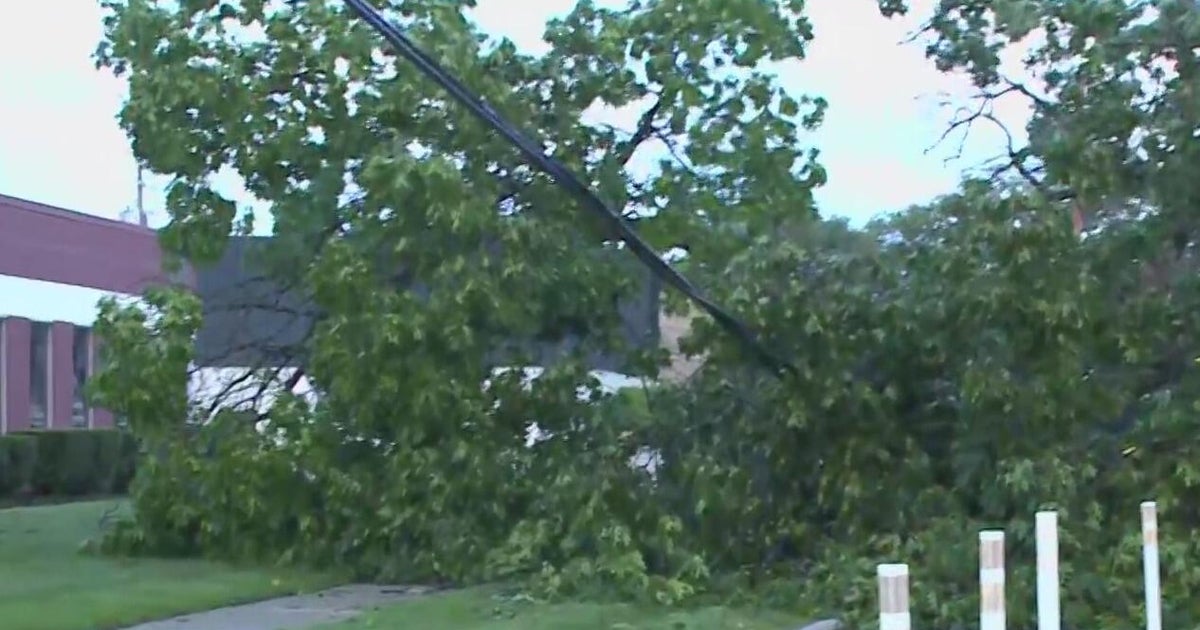
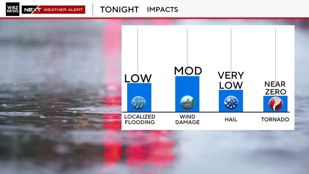
This is a low-end severe weather risk. However, due to the late timing of storms passing by while most people may be sleeping, we wanted to highlight some of the potential risks. The primary weather hazard—should any storm reach severe criteria—is damaging wind and frequent lightning. The secondary threat includes small hail.
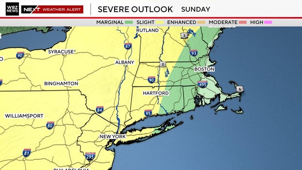
The Storm Prediction Center has included most of New England in this severe weather outlook. The Greater Boston area is under a marginal (level 1 out of 5) severe risk. Western Massachusetts is at greater risk for seeing any stronger storms develop, with a slight (level 2 out of 5) risk.
Much of the weekend was hot and dry. Any developing storm activity will be late Sunday night. The strongest storms are most likely to occur between 9 and 11 p.m. this evening. That said, storms will continue well into the early hours of Monday morning before sunrise. The good news is they are expected to lose strength as they push eastwards toward Boston overnight.
We may pick up close to a much-needed half inch of rain. Especially in instances of frequent lightning and a heavy downpour. Outside of this, there isn't much rain in the short-term weather forecast. Drought conditions prevail in New England.
We dry out pretty quickly after storms roll through. By the time most people are waking up Monday morning, we should be largely drying out. The weather alert will expire before sunrise Monday.
Storms aren't the only thing on our list of weather headlines. We reached 91 degrees in Boston today, marking our 7th 90+ degree day for the year so far. Boston averages 15 days in the 90's each year.