Dangerous combination of hot, dry, windy weather across Colorado creates critical fire weather conditions

Wednesday is a First Alert Weather Day across Colorado as a dangerous combination of hot, dry, and windy weather creates critical fire weather conditions and the potential for rapid wildfire spread.
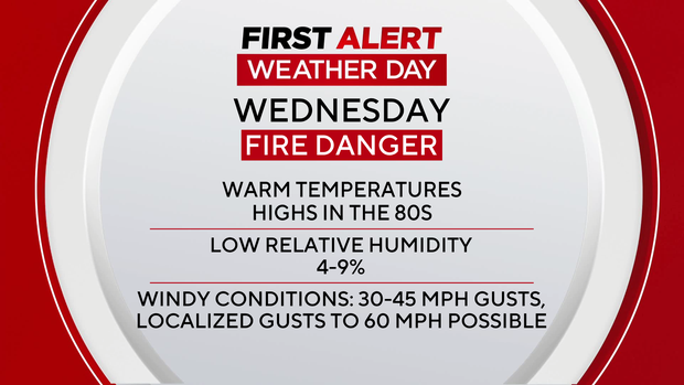
Temperatures are expected to soar nearly 20 degrees above normal on Wednesday afternoon, with highs climbing into the 80s along the Front Range. At the same time, strong southwest winds and extremely low humidity — dropping into the single digits in some areas — will make conditions especially volatile.
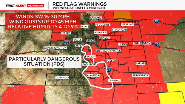
A Red Flag Warning is in effect through midnight for much of eastern Colorado, including the plains, foothills, and South Park. Wind gusts between 30 and 45 mph are expected during the afternoon. Parts of southern Colorado are under a Particularly Dangerous Situation on Wednesday. A PDS designation is rare and signals that fire conditions are not just critical — but extreme, meaning any fire that starts could spread rapidly, behave erratically, and become very difficult to control.
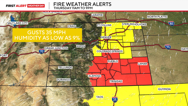
Fire danger won't improve much on Thursday. A Fire Weather Watch is already in place for the Denver metro area. Adding to the concern, strong winds may develop in the higher foothills early Thursday morning. Gusts up to 60 mph are possible above about 8,500 feet,
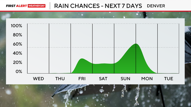
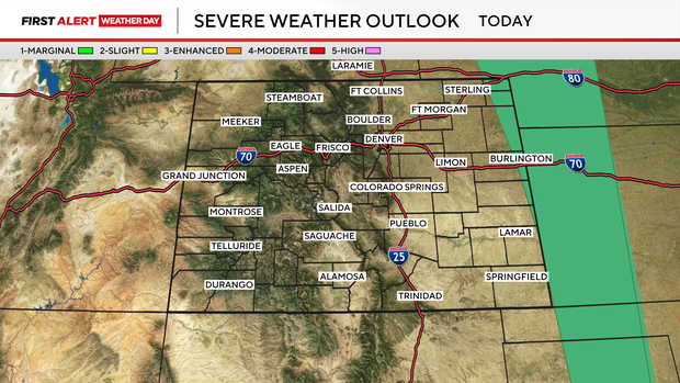
There is a slight chance for an isolated storm for the far northeast plains late Wednesday, but most areas will stay dry. If a storm does form, it would likely bring gusty winds rather than meaningful rainfall.
A cooler and more unsettled pattern is expected to move in by the weekend, bringing temperatures closer to normal and at least a chance for some precipitation, especially by Sunday.