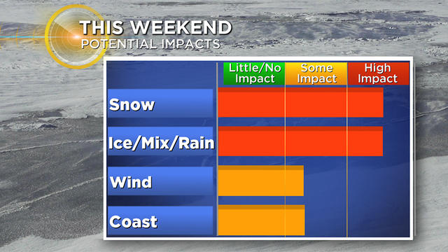
Get The Snowblower Ready: 'Kitchen-Sink' Storm Hitting Boston Area This Weekend
There is no doubt that a storm is coming this weekend.
Watch CBS News
There is no doubt that a storm is coming this weekend.
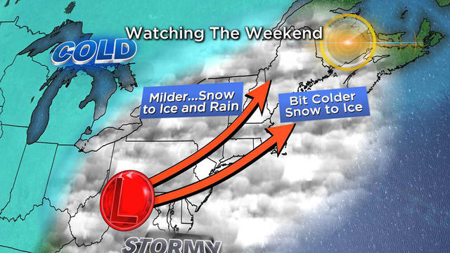
There are two storms to watch in our immediate future.
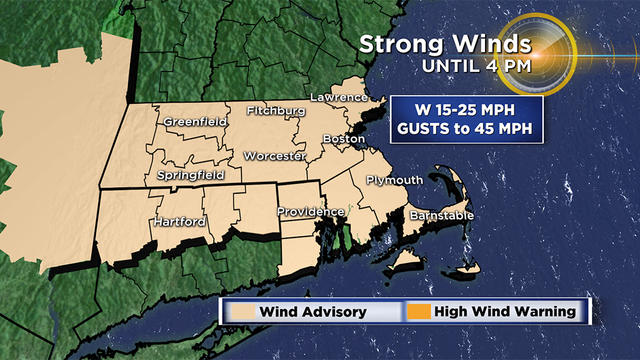
Slow improvements are expected after a damp start to the day.
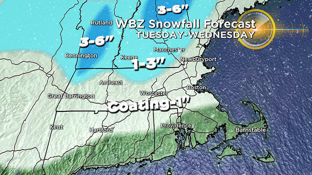
Light snow will arrive early Tuesday morning before transitioning to rain.
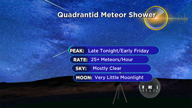
While the weather is quiet, it is a great time to look skyward.
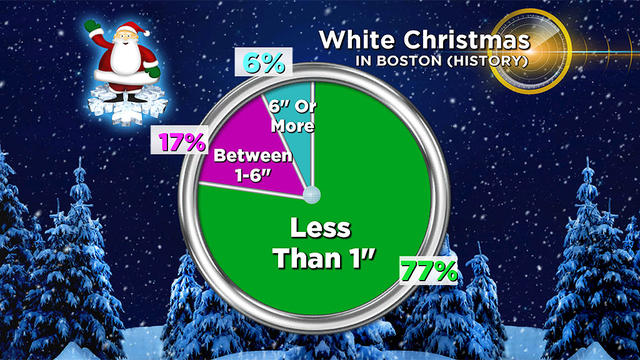
It seems it may take a Christmas miracle to whiten the ground for Santa this year.
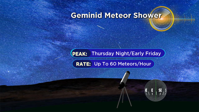
The weather may be quiet but the skies are bustling with activity. Earlier this week there was an International Space Station flyby, and now there are meteors and a comet to look forward to.
The weather may be quiet but the skies are bustling with activity!
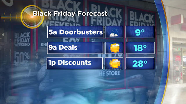
This Thanksgiving we are enduring something that nobody else at the dinner table has ever experienced - not even grandma and grandpa.
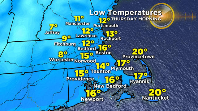
This will be one of the coldest Thanksgivings ever recorded in Boston and current records go back well over 100 years.
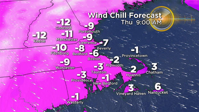
Merry Christmas! Oh wait, it's only November?
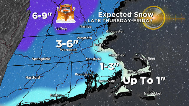
This storm is what we call a classic front end "thump" of snow. You get 3-5 hours of solid snowfall and then suddenly a flip to sleet and rain and your snowfall is done just like that.
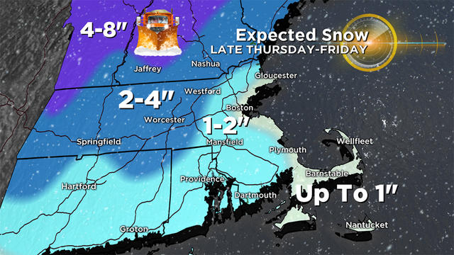
The main concern with this storm is the snow and ice and its effects on the roads.
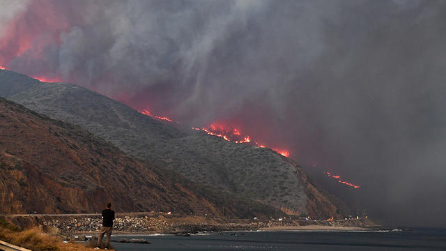
Satellite imagery shows just how massive the fires are.
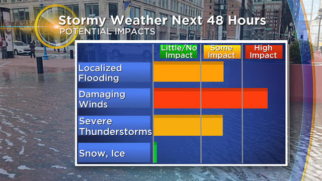
Your weekend plans are going to be rudely interrupted by Mother Nature.
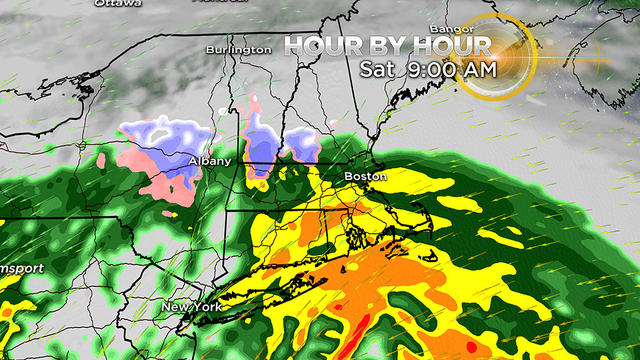
A nor'easter is headed toward New England this weekend, expected to bring wind and rain to the area.
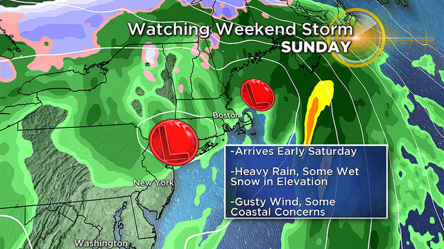
It appears as though a sizable coastal storm will form and affect us this weekend, just days before Halloween.
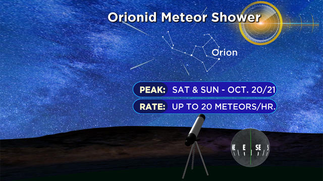
If you are a night owl, it'll be worth looking to the sky this weekend as the Orionid Meteor Shower makes an appearance.
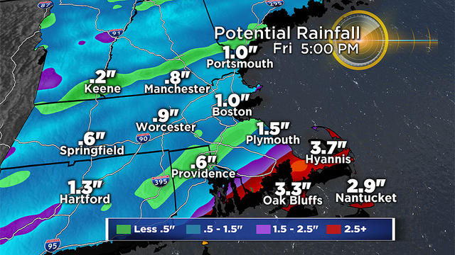
New England will be spared from any major effects from the remnants of Hurricane Michael, but we will be on the fringe of the rain and expanding wind field.
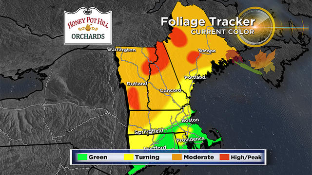
If you're hitting the road this weekend in search of some fall color - where should you go?

The National Weather Service has issued a flash flood watch for most of our area through 4 p.m. Friday.
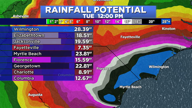
Incredible amounts of water will fall from the sky over the next several days in the Carolinas.
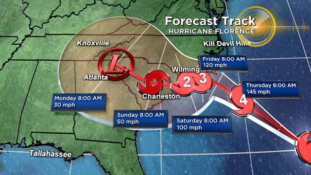
The slightest shift in track will mean an escape for some communities and devastation for others.
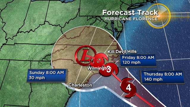
Florence remains a powerful category 4 hurricane and appears to be headed for an eventual landfall in North Carolina later this week.
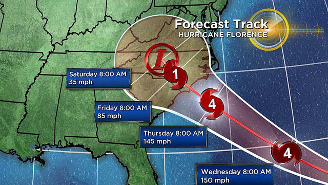
Hurricane Florence has been upgraded to a major category 4 hurricane as of noon on Monday.