Hurricane Michael Remnants Bring Flash Flood Watch To Southern New England
BOSTON (CBS) – Hurricane Michael was downgraded to a tropical storm overnight after making landfall as a major Category 4 hurricane in the Florida panhandle Wednesday.
Michael ended up as the third strongest hurricane to hit the continental United States ever on record.
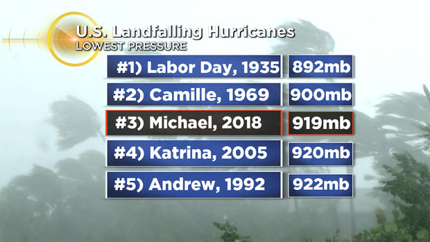
Stronger than Andrew. Stronger then Katrina. Portions of the Florida Panhandle were destroyed as the combination of winds and storm surge devastated parts of the coast. Our thoughts are with those folks in Florida, we can only hope that everyone evacuated.
Unlike Florence, Michael is moving along and will continue to move rather quickly through the southeastern United States and then offshore by Friday. That will limit the rainfall to some degree, but many areas in the path, including parts of the Carolinas, will be in for yet another round of devastating flooding.
Michael will continue to weaken Thursday as it crosses South and North Carolina and zips off to the northeast. The storm will pass about 150 miles southeast of Nantucket around midday Friday. Thankfully, New England will be spared from any major effects from the remnants of Michael, but we will be on the fringe of the rain and expanding wind field.
Here's what we can expect:
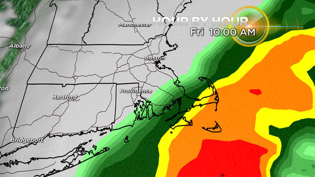
TIMELINE
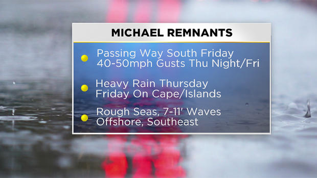
The time period to watch here in southern New England will be Thursday night and Friday morning. A cold front passing through Thursday night will draw up some tropical moisture from Michael and a band of downpours will pass through between 6 p.m. and midnight.
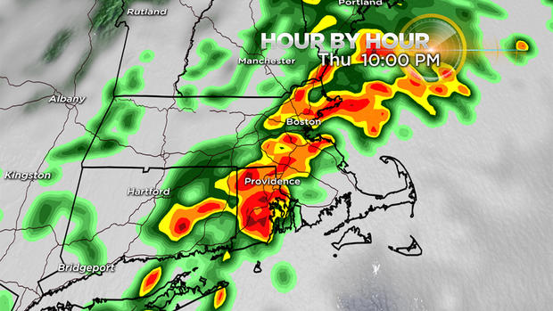
Then another round of heavy rain and gusty winds will likely affect the South Coast, Cape Cod and the Islands Friday morning (as Michael makes its closest pass).
RAINFALL
For the majority of our area, about 0.5-1.5 inches is likely Thursday afternoon through Friday morning. Not enough to cause any major flooding concerns.
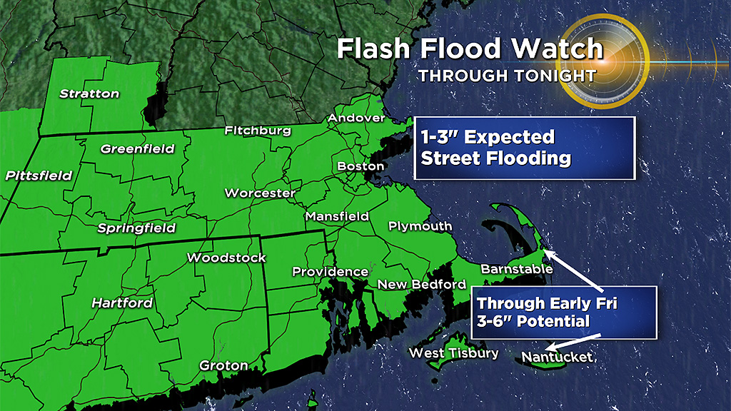
However, heavier rainfall amounts are expected in southern Plymouth and Bristol counties as well as on Cape Cod and the Islands due to their closer proximity to the storm.
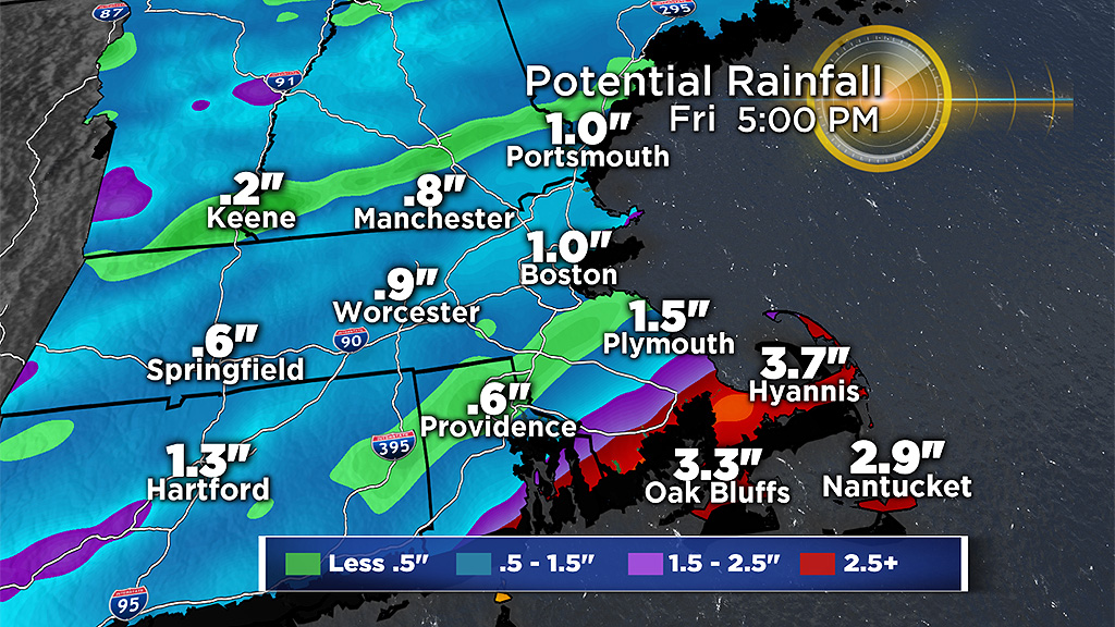
About 1-to-3 inches of rain is forecast in those areas with the possibility of up to 4-to-5 inches locally. This raises the concern of some flash flooding and minor river/small stream flooding.
WIND
While widespread wind damage is not expected from Michael here in southern New England, there may be some minor wind damage along the South Coast, Cape and Islands, perhaps the highest threat being on Nantucket.
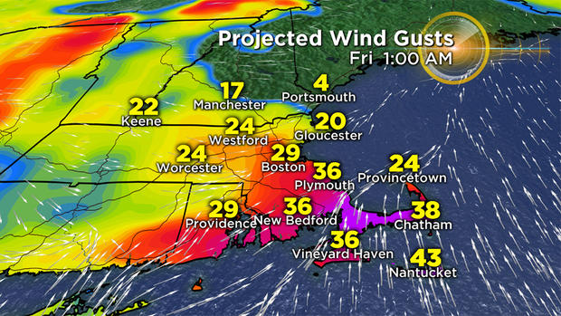
Winds could gust 25-to-50 mph in these areas late Thursday night and early on Friday. This would result in minor tree damage and some scattered outages.
SEAS
The seas will be very rough as Michael approaches and then passes by on Friday.
Seven-to-eleven foot seas are likely over the southern waters Friday and Friday night. Those with marine interests should stay tuned to future updates and warnings from the National Weather Service.
Follow Terry on Twitter @TerryWBZ


