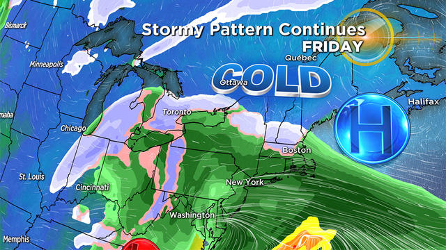
Heavy Rain, Followed By Bitter Cold And Possibly Snow Late In Week
Another round of heavy rain Tuesday will be followed by bitter cold. Then, some towns may see the first accumulating snowfall of the season Friday.
Watch CBS News
Another round of heavy rain Tuesday will be followed by bitter cold. Then, some towns may see the first accumulating snowfall of the season Friday.
Rainfall rates of one-to-two inches per hour are possible as storms and showers make their way across New England.
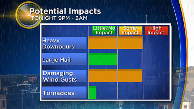
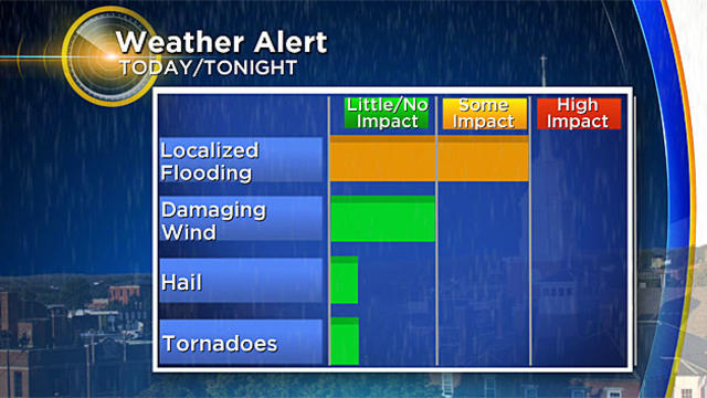
There is a chance for an isolated pop-up thunderstorm in the heat this afternoon, but the main line of storms will move through between 9 p.m. and 2 a.m.
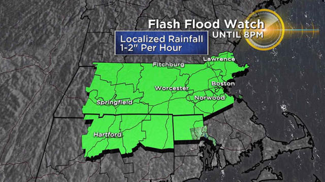
Numerous showers and thunderstorms will develop between 1 p.m. and 8 p.m., some of which may grow to be severe, according to the WBZ-TV Weather Team.
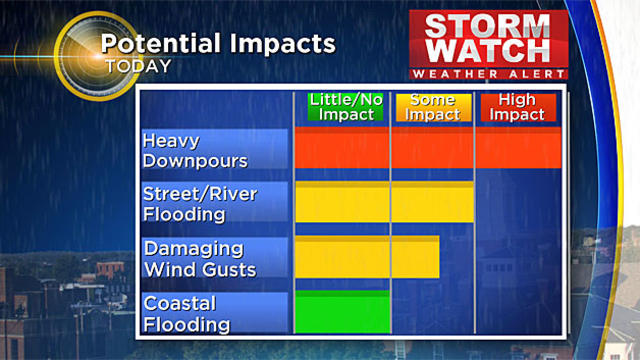
This system will bring us heavy rain, an onshore wind and even some coastal flood concerns Monday night.
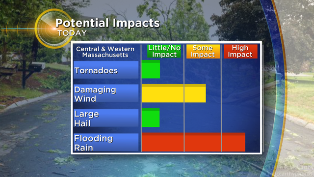
There is the potential for drenching downpours and damaging wind gusts in a few spotty strong to severe storms.
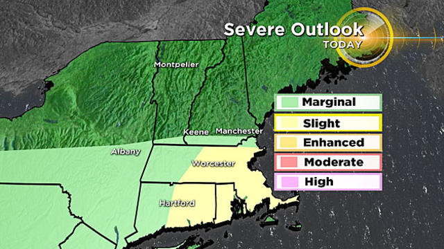
The stage is set for the appearance of a few scattered afternoon to early evening thunderstorms.
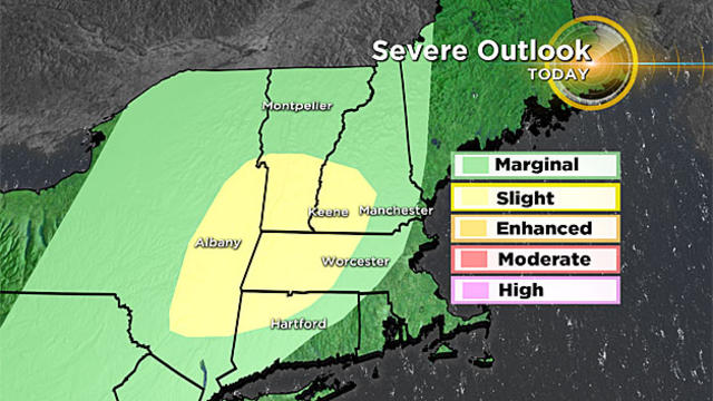
The general time frame we'll be watching Wednesday is between 3 and 11 p.m. from west to east.
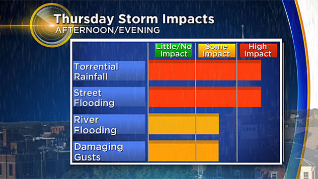
There's a threat for flooding Thursday into Friday.
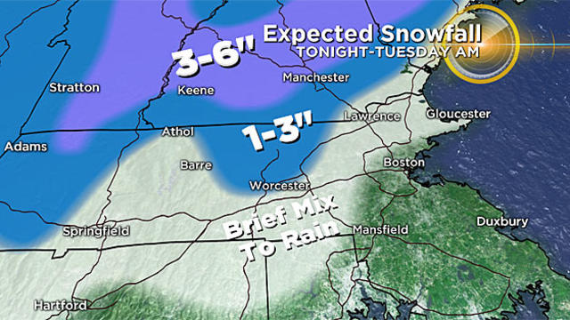
The brunt of the storm arrives Monday evening and lasts into Tuesday.
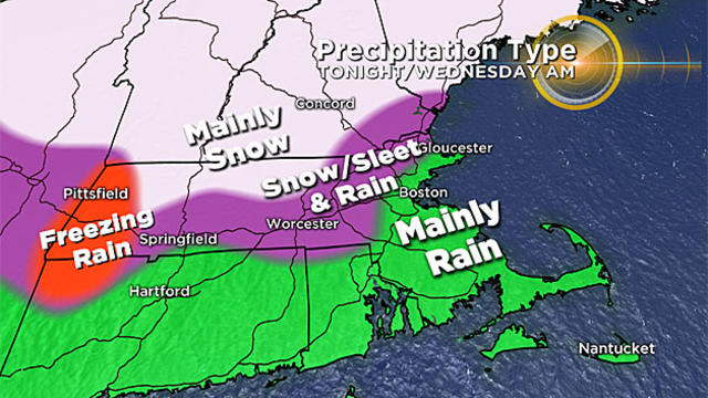
This storm will feature a very heavy, wet snowfall for areas well to the north and west of Boston.
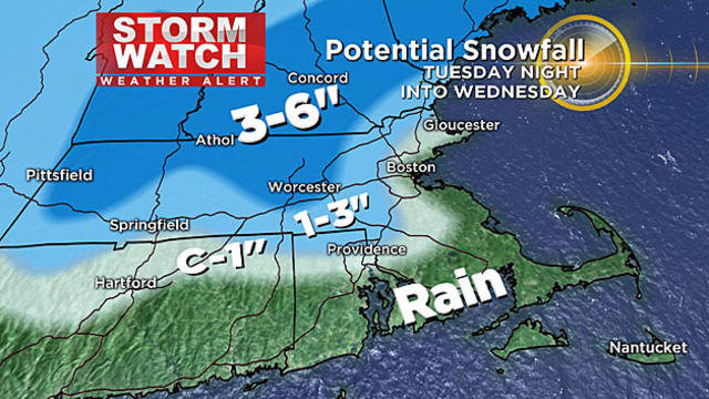
This is the same storm that brought ice accumulation across the central Plains over the weekend.