Heavy Rain, Followed By Bitter Cold And Possibly Snow Late In Week
BOSTON (CBS) – Boston has seen 45.79 inches of rain this year making 2018 the wettest year since 2011 (52.39 inches) and we still have another 6 weeks to go!
So it's no surprise we've picked up 4.45 inches of rain this month after another weekend that included wet conditions (make that the sixth in a row now). Well, here we go again, we've got another round of heavy rain moving in today.
It will be quick to move through, but once again, localized flooding and strong wind gusts will be a concern with the biggest impacts to the Tuesday morning commute. A bitter cold chill will follow for midweek.
Early Tuesday
This is the period of heaviest rain and highest risk of urban/street flooding.
Precipitation begins in the early morning with the heaviest through midday. Most of the area will see mainly rain, but it may be cold enough for a light snow accumulation across the higher elevations of western Mass. into southern Vermont before changing over to rain.
Rain will exit from west to east by early Tuesday afternoon. We anticipate .75-to-1.5 inches of rainfall, with locally higher amounts. The biggest impact will be for the Tuesday morning commute with large puddles and ponding in shallow spots.
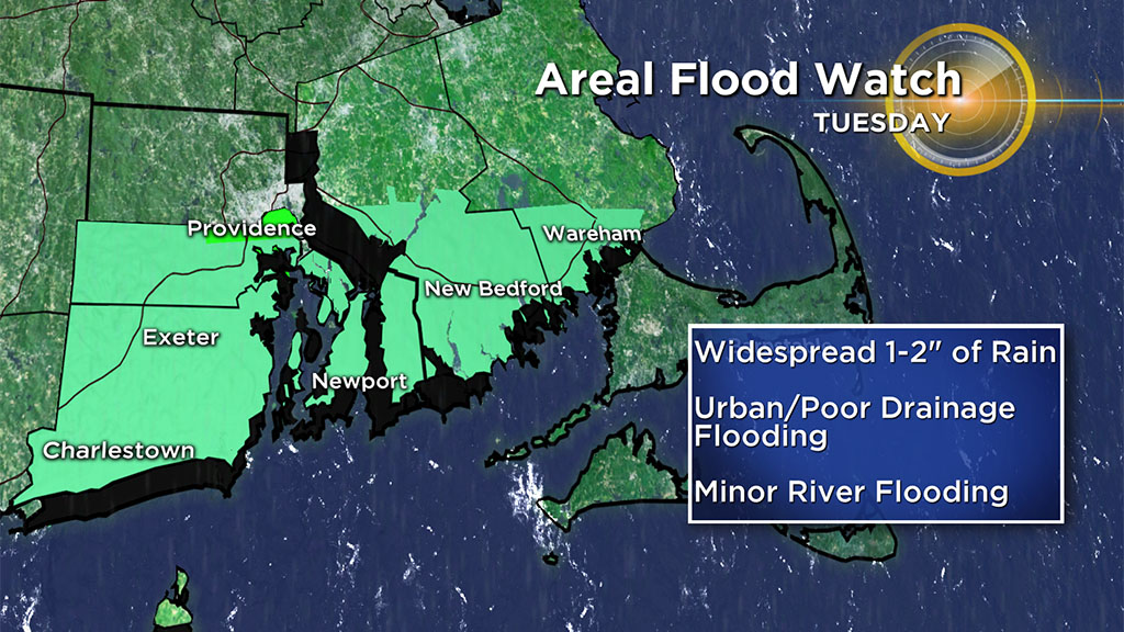
A Flood Watch is in effect for southern Bristol and Plymouth counties for the potential of flooding with a widespread 1-2" expected in this area.
Make sure to clear any storm drains of debris or leaves, as that may help alleviate street flooding concerns. Additional rain may also lead to small streams and or minor river flooding.
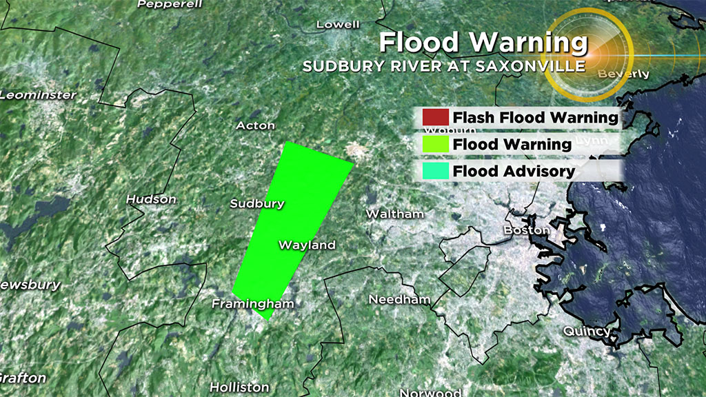
A Flood Warning is in effect for the Sudbury River at Saxonville. The river is expected to reach flood stage on Tuesday with improvements by Wednesday.
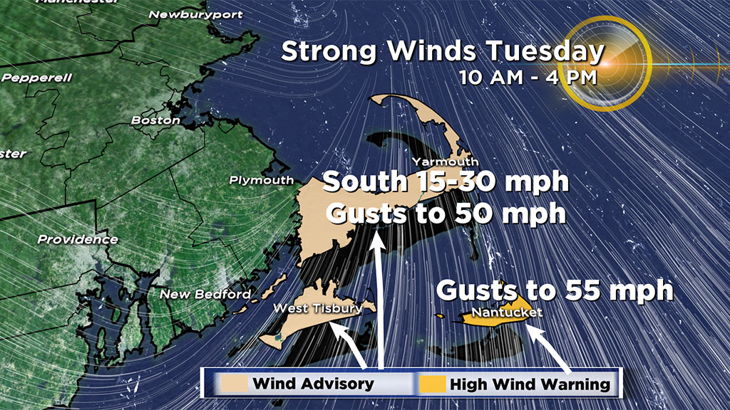
Strong to damaging south to southeasterly winds are anticipated midday Tuesday, mainly over southeastern New England. A Wind Advisory is in effect for Cape Cod and Martha's Vineyard and A High Wind Warning is in effect for Nantucket from 10 a.m. until 4 p.m., where the strongest winds are expected. Southerly wind gusts 40-to-55 mph are possible which may lead to scattered tree damage and power outages.
Tuesday Evening
The rain will be done and clouds will be decreasing. However, strong westerly winds will develop through Tuesday night. Gusts to 35 mph are possible. This wind will help transport cold air into the region.
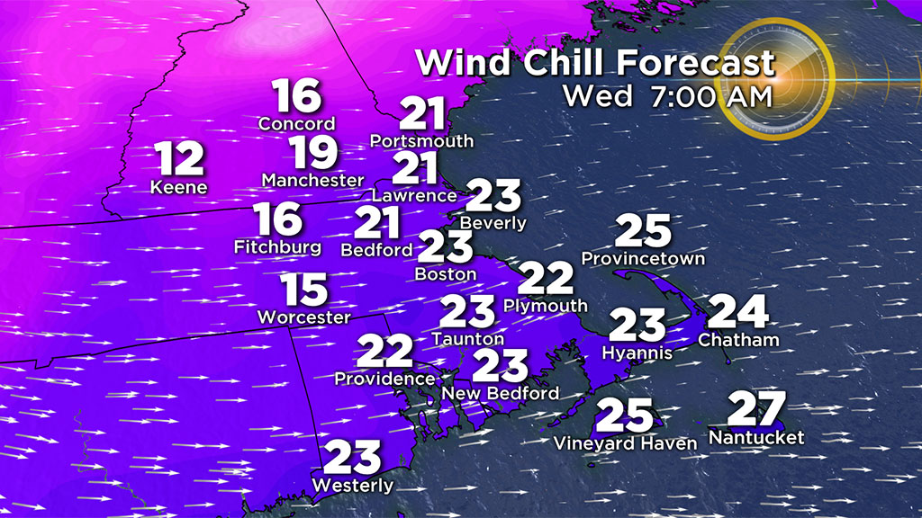
Temperatures will drop into the 20's by Wednesday morning with wind chill values in the teens and 20's for the morning drive.
Mid-to-Late Week
The sun returns, but it will be cold on Wednesday!
Temperatures will only reach the 30's in the afternoon, a definite sting in the air as it remains blustery. Highs will remain 10 to 15 degrees below normal through Thursday keeping the winter feel going.
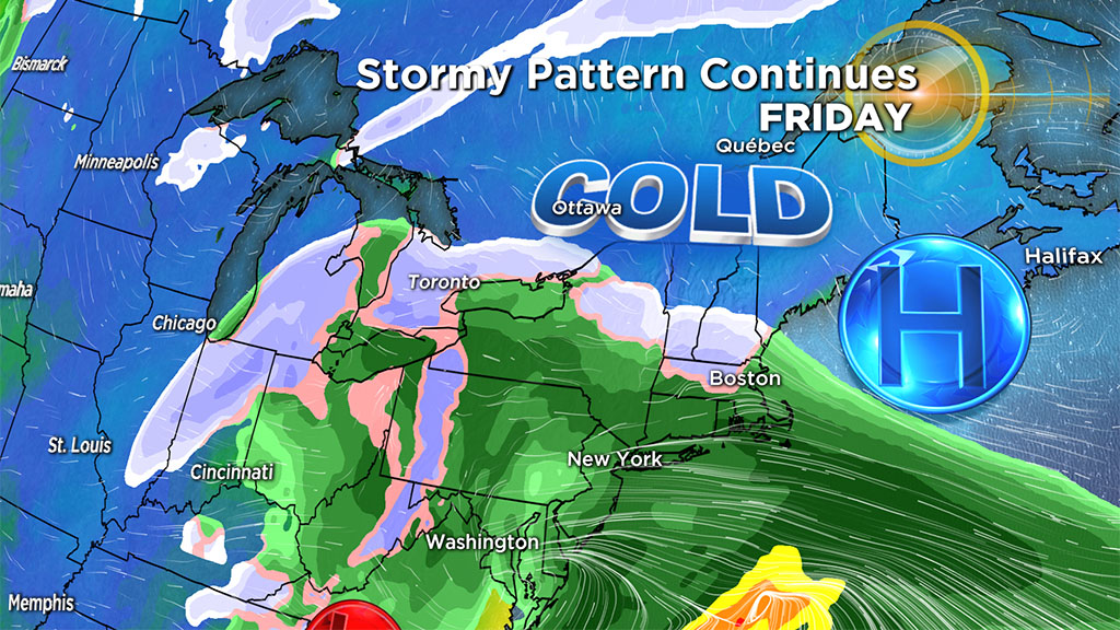
With cold air in place, we look to our next coastal storm heading our way late week. Some parts of the area may see the first accumulating snowfall of the season before a changeover to rain on Friday.
We'll continue to monitor for any changes in track and timing as we get closer.