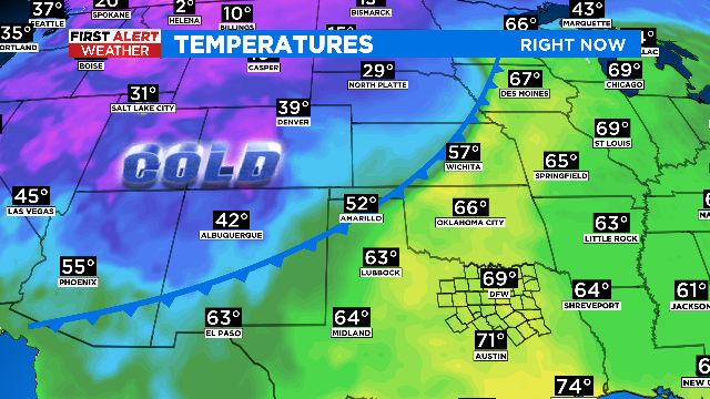
Sweater weather! Season's strongest cold front slides through North Texas
We're tracking some huge changes in our forecast so get your warm clothes ready.
Watch CBS News
We're tracking some huge changes in our forecast so get your warm clothes ready.

The National Weather Service has issued an update about the tornado that tore through Lamar County on Nov. 4, saying it was an EF-4.
Law enforcement officials said two of the 10 people injured were in critical, but stable condition at Paris Regional Medical Center.

CBS 11 meteorologists expect strong to severe storms to develop through the late morning/early afternoon on Friday.
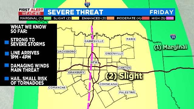
Severe weather is likely Friday afternoon with damaging winds being the biggest threat, and a secondary threat from hail and isolated tornadoes.

Heavy rain, isolated strong storms and gusty winds make Friday, Oct. 28 a First Alert Weather Day. But it's not a weekend washout.

Heavy rain and some strong storms could cause widespread disruptions on Friday.
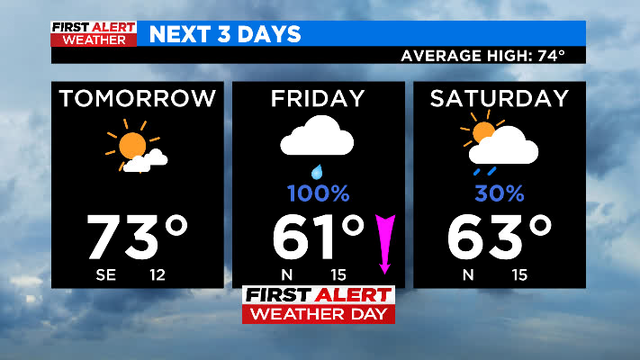
Weather conditions Friday morning will cause a messy commute as a line of storms moves from west to east.

Heads up! We could have periods of heavy rain and potential isolated storms on Friday with the cold front.

Hold on to your hats today, as winds could gust up to 40-45 miles per hour.
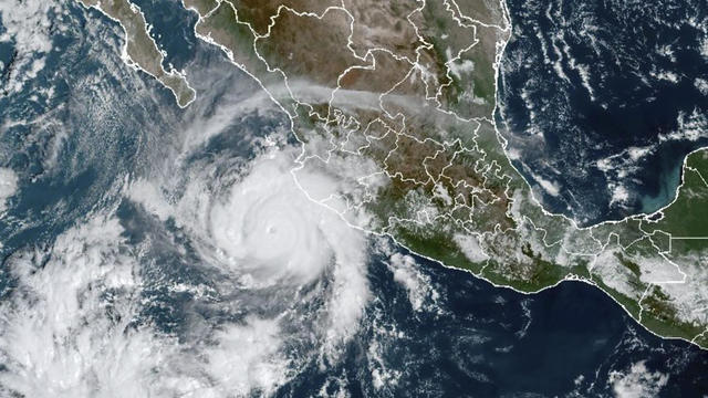
The storm slammed into a sparsely populated stretch of Mexico's Pacific coast between the resorts of Puerto Vallarta and Mazatlan Sunday morning.

A cold morning is on tap for Wednesday with temperatures in the 30s and 40s expected.
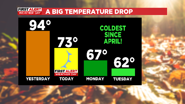
Dramatic changes in the weather are in progress.
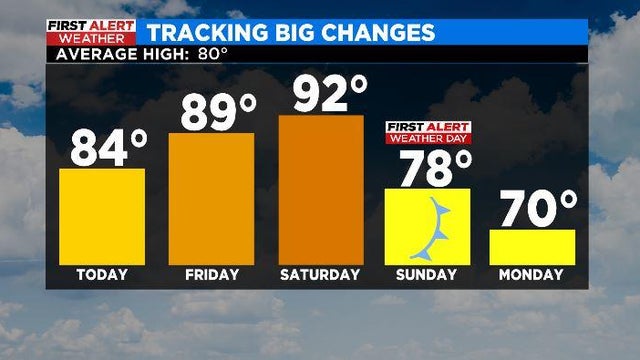
Get ready North Texas, a strong cold front arrives this weekend and it'll have you reaching for those layers!
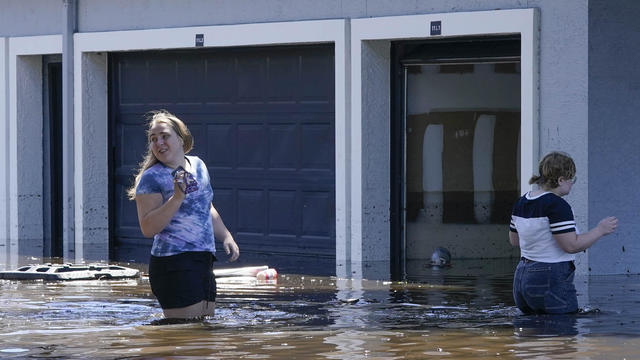
At least 28 people died due to the storm, and many more were left without a home.

Crews have faced "devastating circumstances" and "unrecognizable terrain," Rear Admiral Brendan McPherson said.
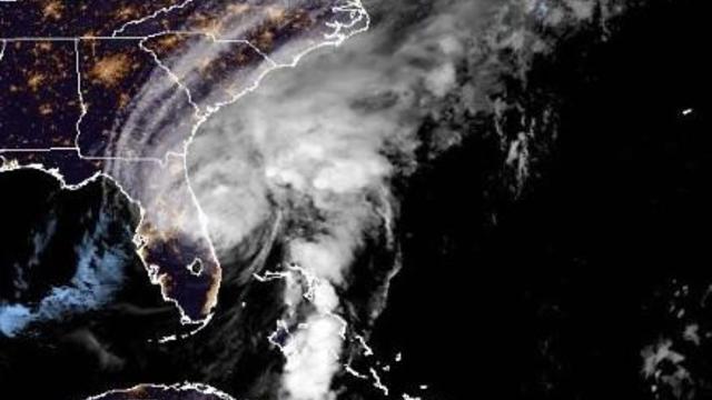
It made landfall over southwestern Florida as a major Category 4 hurricane and, while downgraded, was still packing a powerful punch overnight.

Record rainfall in North Texas since Sunday night led to hundreds of high water rescues and at least one fatality in Dallas.

Several inches of rain in a short period of time Monday caused a Balch Springs creek to overflow, flooding several homes.

A First Alert Weather Day is being declared for Sunday and Monday due to the possibility of flooding in North Texas.

Right now this summer ranks third on the last of all-time hottest summers in the 123-year history.
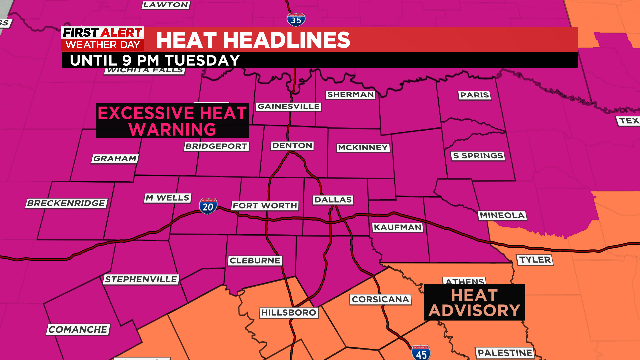
First Alert Weather Days have extended into Wednesday in anticipation of the hottest days North Texas has seen since 2018.
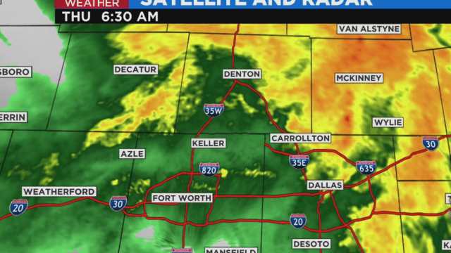
Rainfall rates in some areas of the Metroplex are estimated at up to 3.5".

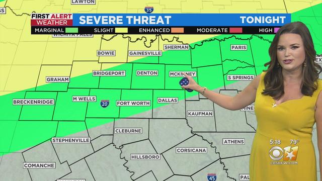
Scattered storms return starting tonight and continuing through tomorrow morning but the severe threat remains fairly low.
Strong summer feel remains today. It will be hot and humid with some sunshine and high temperatures in the 90s.