Flash flood warnings continue into early Thursday morning as storms leave North Texas


Severe thunderstorms Wednesday evening stalled along a frontal boundary across the metroplex. Waking up Thursday morning, counties that received some of the heaviest rainfall totals should be cautious about driving in the dark, avoiding flooded roads.
A flash flood warning has been issued for Van Zandt County until 2 a.m. Thursday morning. This includes life-threatening flash flooding in the area for that county. Some locations that will experience flash flooding include Canton, Wills Point, Edgewood, Fruitvale, Lake Tawakoni, Myrtle Springs, Wise and Alsa.
Dallas County is under a flash flood warning through 1:45 a.m. Thursday morning. This includes parts of Kauffman and Rockwall counties.
The greatest flooding threat will remain across southwestern Dallas County. About 3-5" of rain has already fallen, with an additional 2-3" expected. Multiple cars have been reported stranded in water, with water rescues reported.
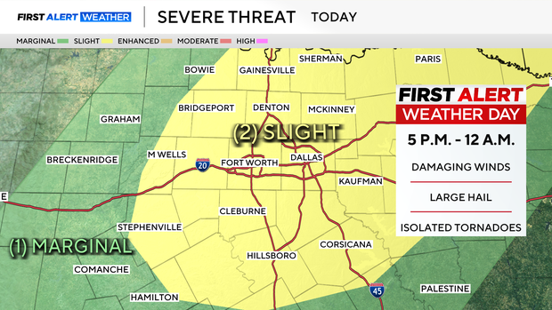
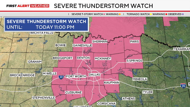
A severe thunderstorm watch has been issued until 11 p.m. for Collin, Cooke, Dallas, Delta, Denton, Ellis, Fannin, Grayson, Hood, Hopkins, Hunt, Johnson, Kaufman, Lamar, Parker, Rains, Rockwall, Somervell, Tarrant and Wise counties.
In Garland, the roof of a warehouse in the 2900 block of W. Kingsley Road near Shiloh Road collapsed under the weight of heavy rain just before 5 p.m. A Garland Fire Department spokesman said no one was hurt.


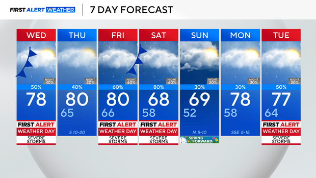
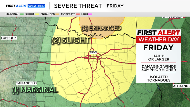
There will be a break in the action Thursday for North Texas. Highs will still climb into the 80's before storms return Friday afternoon, evening and night. There will be some severe storms with another risk of hail and tornadoes.
There's also an increased risk of flooding by the second half of the weekend as rainfall totals when all is said and done may reach up to 4" across DFW. Shower and thunderstorm chances remain in the forecast well into next week, with Tuesday, March 10, as the best chance.