Warming trend continues in North Texas before short cold front later this week
Despite the cloud coverage on Wednesday, our southerly flow continued to boost our temperatures into the mid-60s in the afternoon, which makes for a warmer day than Tuesday, with temperatures staying above-average for this point in the year.
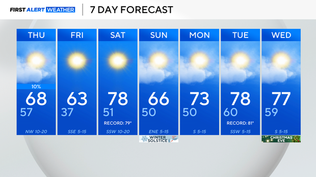
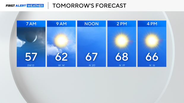
As we head into Thursday, highs continue to warm into the upper 60s during the afternoon, with a bit more sunshine late-day.
We will be fairly breezy, and that is out ahead of an approaching cold front that moves through Thursday into Friday.
That front is mainly dry, outside of an isolated sprinkle chance, mainly east on Thursday.
By Friday, highs fall briefly, back into the lower 60s, before starting to warm into the weekend. Saturday will push close to records as our southerly winds send temps up into the upper 70s. That puts us nearly 20° above average for this point in the year.
Another dry front moves through Sunday, ahead of a warming trend next week.
Long-range, our Christmas Eve and Christmas Day forecasts are trending very warm, with highs well into the 70s, and dry conditions lingering through the holiday and beyond.