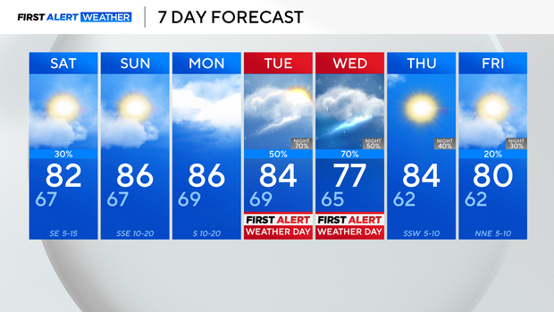
Warm weekend ahead before severe weather threat in North Texas on Tuesday and Wednesday
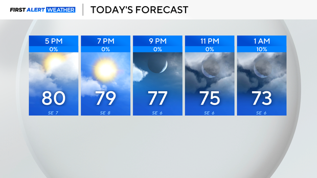
A much drier day on Friday brought scattered showers that lingered along the Red River into our northeast areas.
Clouds have been slow to clear in some spots, leading to a range in temperatures.
Temperatures have reached the lower 80s in sunnier areas, while regions with lingering clouds remain in the mid-70s.
Plan for partly cloudy skies this evening and overnight lows in the upper 60s.
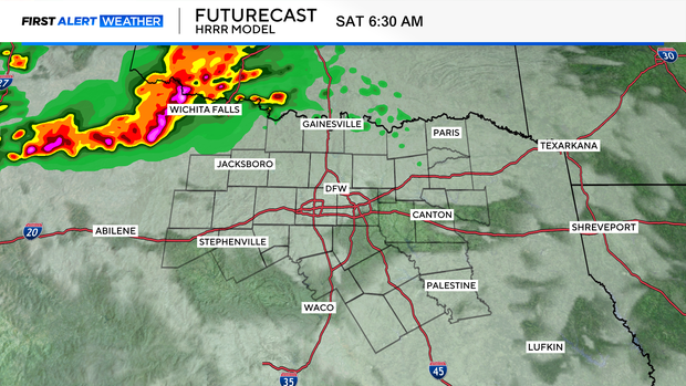
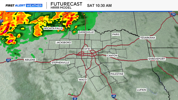
We will be watching a complex of storms develop along the dryline to our west and head eastward overnight.
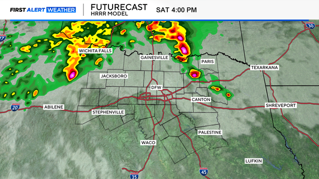
Models are tracking the storms along the Red River, weakening as they approach North Texas around sunrise tomorrow.
If the line holds together, scattered showers may occur in the Dallas-Fort Worth area.
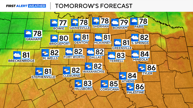
On Saturday morning, temperatures will start off in the upper 60s and climb into the lower 80s.
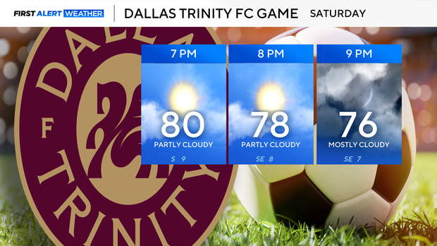
Plan for a warm evening if you are heading out to the Dallas Trinity FC game at the Cotton Bowl tomorrow night.
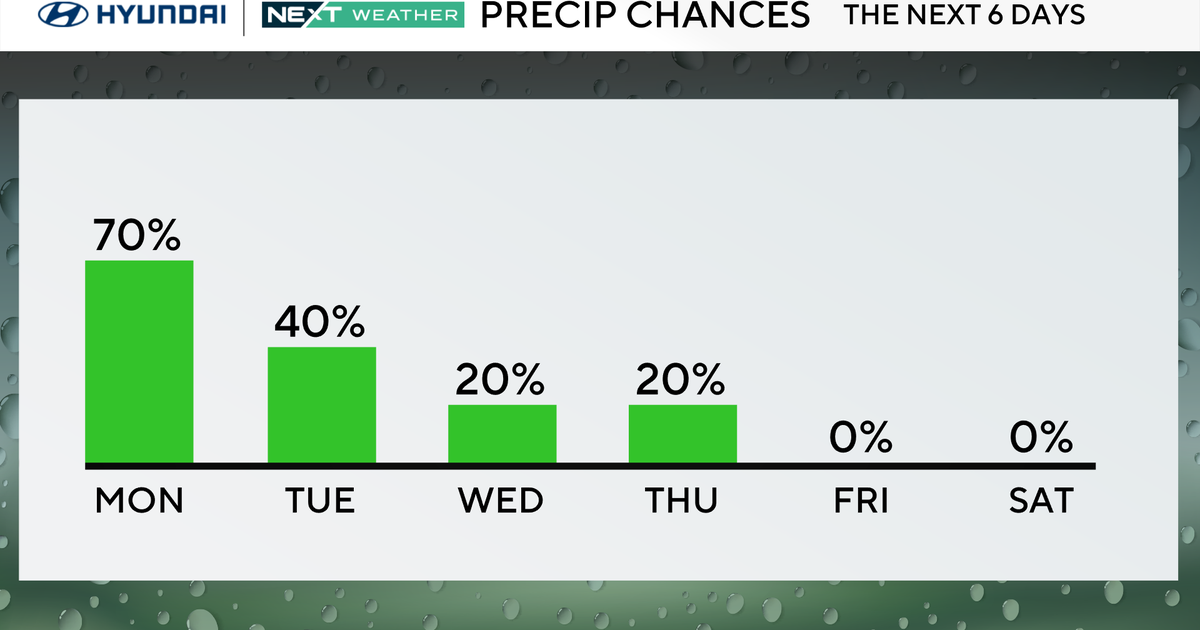
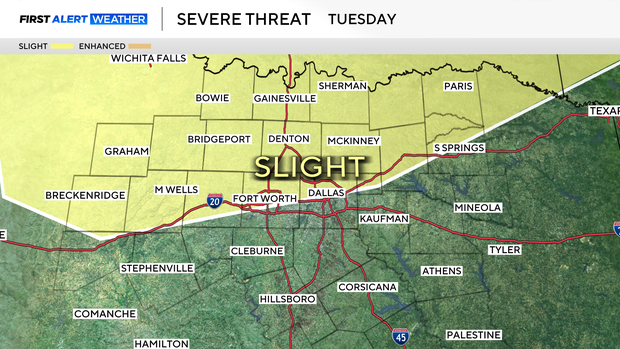
First Alert Weather Days are in place for Tuesday and Wednesday due to the threat of strong to severe storms.
Please stay updated on the forecast as details regarding threats and timing come into better focus.
The Storm Prediction Center has already highlighted the Metroplex for a slight risk of severe storms on Tuesday.
Sunday will be a great day to get outside with a mix of sun and clouds and highs in the mid-80s.
Monday is expected to be cloudy and dry during the daytime hours, but storms may move in during the evening.