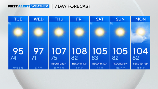
The extreme heat pushes back in by Thursday through the weekend

NORTH TEXAS (CBSNewsTexas.com) - The Metroplex will see two more days of something other than 100° heat before going right back to near-record highs.
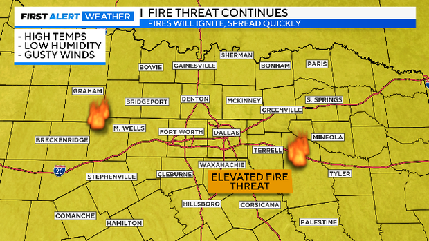
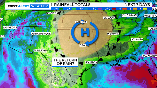
There is still no rain in the forecast for the week ahead and the elevated fire risk continues.
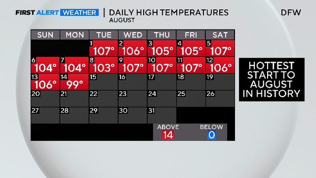
Some wouldn't even call it a difference but on Monday at DFW, for the first time in three weeks, it did not hit 100° - It only hit 99°. It's hardly a celebration but at least a little bit of better news in what has been the hottest start to our hottest month.
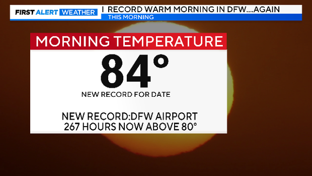
We did break a record on Monday, by the way. We again had a record-warm morning at 84°. DFW now has the longest streak of hours above 80°. As of 5 p.m., that's 267 hours and counting.
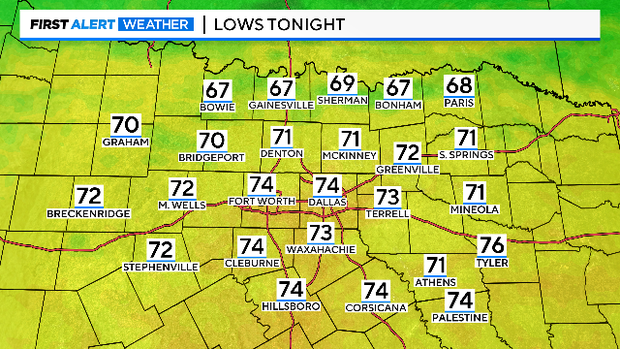
We ended the 100-degree streak Monday, and we end the 80° streak Tuesday. Lows are expected to be in the 70s for the first time in two weeks.
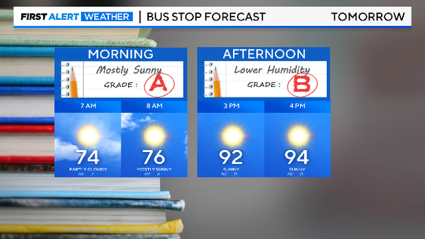
For the kids going to school Tuesday, it'll be a nice morning and not so bad of a summer day.
Elevated fire risk continues this week as we keep waiting for some rain.
No rain in the 7-day forecast and no significant shift in the weather pattern. But with the heat dome sitting a little more north of us by the weekend, the Gulf will open up a little more. We could start talking about rain chances next week.
But for the week ahead not much in good news. Not only are we back in the heat by Thursday, we are back to near-record heat. Wow.