Severe Thunderstorm Watch issued for parts of North Texas until 10 p.m.
NORTH TEXAS (CBSDFW.COM) – The cap is winning out on this First Alert Weather Day…for now.
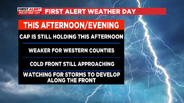
The National Weather Service office in Fort Worth actually released two special weather balloons this afternoon, the first around midday and the second around 3 p.m. Both were showing a strong cap remaining over the metroplex, and that cap has limited any cloud/storm development across the area this afternoon. In our far western counties, out towards Archer, Jack and Clay counties, there have been a few storms that have developed but everything has remained below severe limits.

All of these storms are still well ahead of the cold front that will move through North Texas tonight though, and as that front passes we may still see some storm development. With that in mind, the National Weather Service has issued a Severe Thunderstorm Watch through 10 p.m.
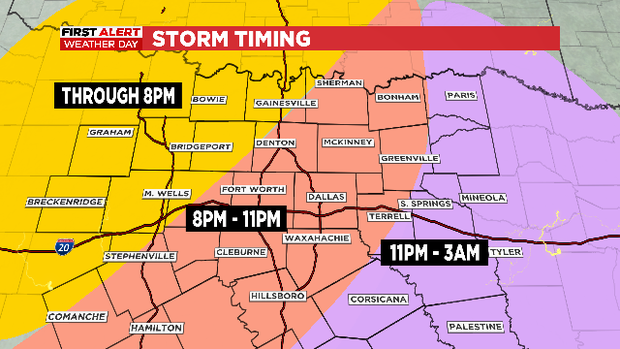
Storm severity may still be limited by the cap, but we will monitor any storm development for large hail and damaging winds. The tornado threat is low, but not zero.
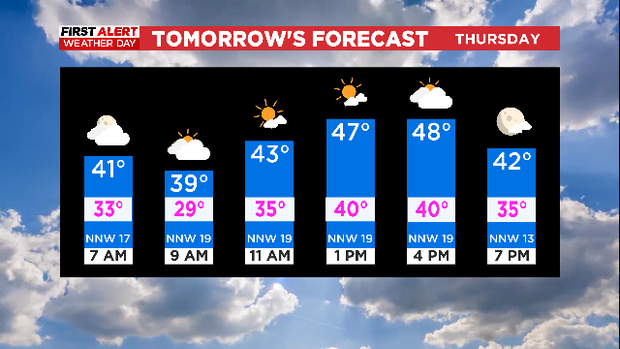
Regardless of whether we see severe storms overnight, a cold front will blow through and knock temperatures down 30+ degrees for Thursday. Highs are expected in the 40s and wind chills will be in the 30s and low 40s at best.