Severe storms move through North Texas counties

9:38 p.m. Thursday - The National Weather Service in Fort Worth has issued a severe thunderstorm warning for southwestern Erath County, Eastland County, and Comanche County until 10:30 p.m.
As of 9:37 p.m., a line of severe thunderstorms was moving southeast at 40 mph, with storms located from Ranger to Rising Star.
8:50 p.m. Thursday -- All storms west of Dallas-Fort Worth have now merged into a single cluster, according to the National Weather Service.
The primary threat is strong winds, though isolated severe hail remains possible within the more intense cores. The cluster is tracking almost due south.
A new warning will be issued at the top of the hour for Stephens and Eastland counties, highlighting the potential for wind gusts up to 60 mph and hail up to 1 inch in diameter.
7:42 p.m. Thursday - The National Weather Service in Fort Worth has issued a severe thunderstorm warning for central Palo Pinto County until 8:45 p.m.
As of 7:42 p.m., a severe thunderstorm was located over Palo Pinto, about 14 miles west of Mineral Wells, moving south at 10 mph. The storm is producing 60 mph wind gusts and quarter-size hail, which may cause damage to vehicles, roofs, siding, and trees.
Areas expected to be impacted include Palo Pinto, Lake Palo Pinto, Santo, Brazos, and Lone Camp.
6:44 p.m. Thursday - The NWS has issued a severe thunderstorm warning for northern Young County until 7:45 p.m.
As of 6:44 p.m., a severe storm was located near Elbert, about 8 miles west of Olney, moving east at 25 mph.
5:48 p.m. Thursday - The NWS has issued a severe thunderstorm warning for southeastern Young County, southwestern Jack County, and northeastern Palo Pinto County. The warning is in effect until 6:45 p.m. CDT.
As of 5:48 p.m., a severe thunderstorm was located about 8 miles south of Bryson or 10 miles east of Graham, moving southeast at 20 mph.
---
Earlier, the NWS said severe storms capable of producing large hail and damaging winds were possible across North Texas on Thursday.
A severe thunderstorm watch is in effect for Grayson, Denton, Wise, Montague, Hunt, Palo Pinto, Eastland, Stephens, Cooke, Denton and Collin counties until 10 p.m.
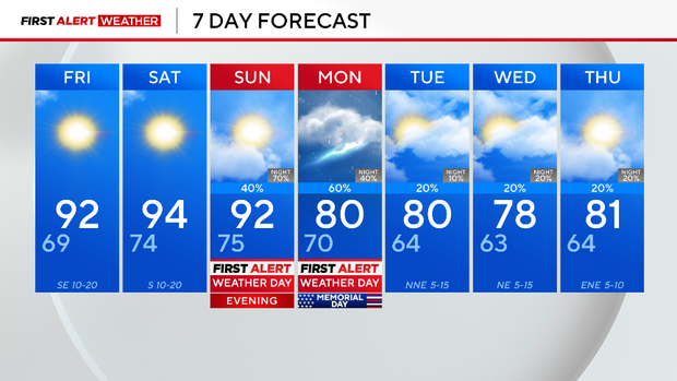
Thursday is a First Alert Weather Day for the potential of strong to severe storms in the afternoon and evening hours.


The primary threats include large hail 2" in diameter or larger (hen egg size) as well as damaging winds 70 mph or stronger. The tornado and flooding threat is low, but non-zero. The timing of the activity will linger throughout the evening, with storms diminishing by midnight.
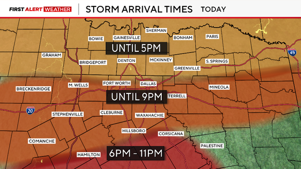
Storms will move southeast and are expected to remain west of DFW Airport Thursday night. There is a chance that additional storms develop and move into the metroplex.

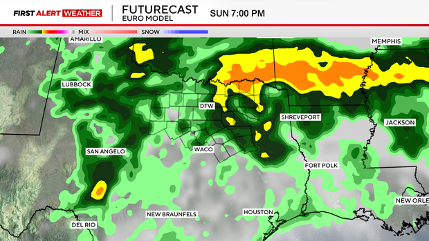
Saturday and Sunday temperatures will climb, and a lot of moisture will be in the air; this will result in the heat index value feeling more like the triple digits. A cold front is on the way, but it will bring storms.
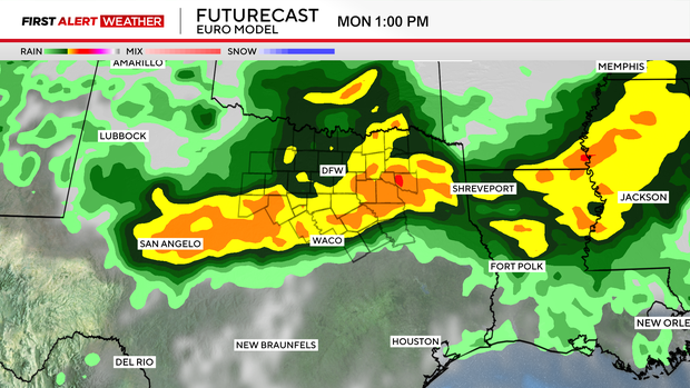
A First Alert Weather Day has also been issued for late Sunday night and Memorial Day.
Expect an active forecast starting Sunday afternoon and continuing into Memorial Day.