North Texas is cool, cloudy to start winter solstice ahead of possibly one of the hottest Christmases in history


Sunday was the winter solstice, the shortest day of the year.
DFW logged 9 hours, 59 minutes, and 44 seconds of daylight. It'll take six months, but starting on Monday. we'll incrementally add a total of 4 hours and 19 minutes of daylight by June 21, the summer solstice.
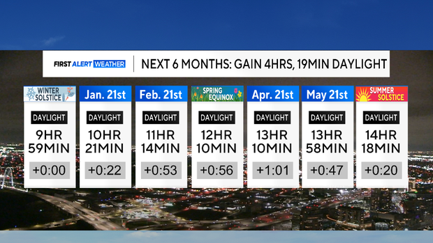
By this day next month, we'll have added 22 minutes of daylight. Starting in February, the days get a little less than an hour longer each month. We don't get exactly 12 hours of daylight on the spring equinox because we define sunset/sunrise as when the sun's upper disk touches the horizon and not when the center of the sun passes that point.
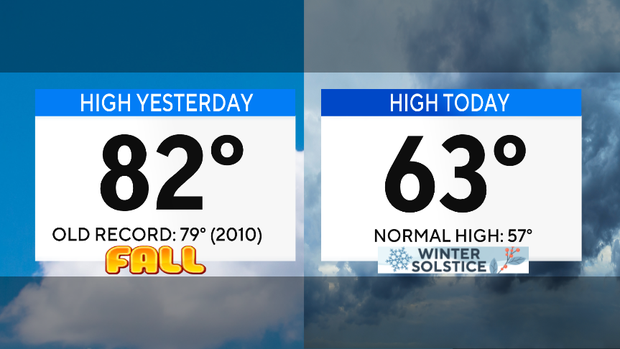
Sunday was still six degrees above normal. Starting Monday, it gets even warmer than that.
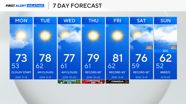
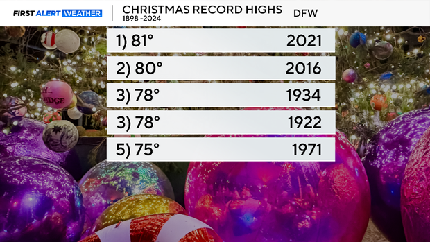
The average high on April 20 is 77 degrees. The average high for Monday through Friday this week will be 77 degrees. So yes, winter starts like spring. We are forecasting the third-warmest December on record. The warmest one ever (82°F) was just a couple of years ago.
There is no rain in the forecast. Monday will start cloudy before clearing. Cloudy starts will occur just about every day this week, before we enjoy some afternoon sun. Near record highs Tuesday through Friday.