Severe storms threaten North Texas ahead of cold front bringing 40-degree temperature drop

North Texas was off to another warm start Wednesday morning, with temperatures in the 70s and 80s and partly to mostly cloudy skies. Feels-like temperatures this afternoon will reach 103°.
There is a 20% chance of an isolated shower or thunderstorm this afternoon, with better coverage north and west of the metroplex into Wednesday night.
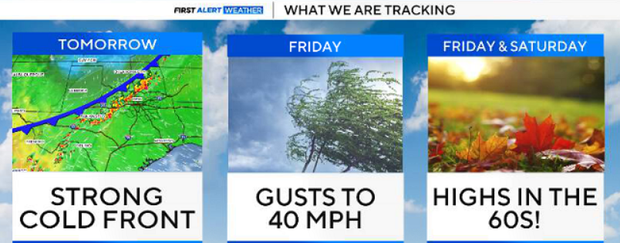
The big story will be the strong cold front moving in by Thursday afternoon. The timing of the front looks to be speeding up, with it moving in late Thursday and pushing south of us on Friday. Ahead of this, there is a chance for isolated strong to severe storms tonight, mainly north and west of the metroplex. Damaging winds will be the main threat.
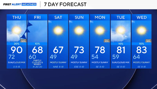
On Thursday, highs will be in the 80s, then will quickly fall overnight into the low 60s. There is a chance of isolated showers and thunderstorms Thursday afternoon into the overnight as that front pushes in, with most of the shower and thunderstorm activity staying just west of I-35, but we're not ruling out some early shower activity Friday morning.
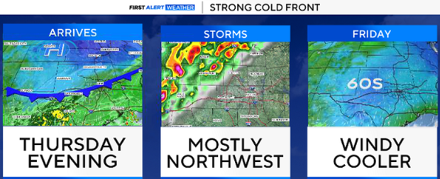
On Friday, the two stories will be the strong winds gusting up to 40 mph and the noticeably cooler temperatures.
Highs Friday likely stay into the 60s area-wide, with temperatures on Saturday morning dipping into the 40s. Saturday afternoon and Sunday morning will likely feature lows in the 40s and highs in the 60s once again. By Sunday afternoon, we start warming back up into the 70s, and the 80s return by next week.