Potential record-breaking heat to hit North Texas this week as rain chances increase


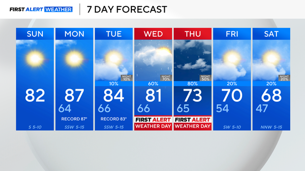
It was a hot Saturday, so warm that the high temperature reached 89 degrees at DFW Airport. This scorched the previous daily record that was 87 degrees set in 1960.
Due to a ridge of high pressure, the above-average temperatures are here to stay over the next few days.
Sunday, a weak front will move across the area, knocking temperatures down a few degrees. The high is still expected to be in the 80s, and there will be sunny skies as well as winds from the south around 5 to 10 mph.

Temperatures will climb Monday and Tuesday near or above the record. Expect well-above-average temperatures to linger in the forecast until Wednesday.
The next big cold front and rain are on the way. A First Alert has been issued for Wednesday and Thursday for disruptive heavy rain. At least 2-4 inches of accumulation is possible during a short window, which will lead to a heightened flooding threat. The cold front will swing through, cooling temperatures off for the weekend.