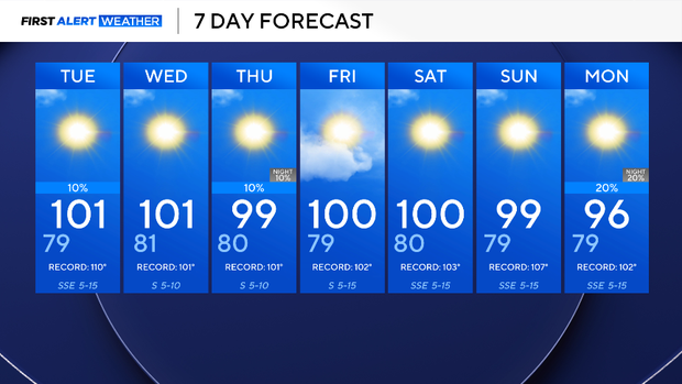
Labor Day temperatures will be above average as a heat advisory hits North Texas


A ridge of high pressure is leading to above-average temperatures and mostly dry conditions. A heat advisory is in effect until 8 p.m. Monday for dangerously hot temperatures. Be sure to take heat precautions.
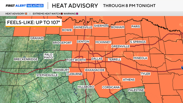
Monday night, expect temperatures to dip into the mid-90s after sunset. Tuesday, the day will start with a low in the upper 70s and top out around 100 degrees in the late afternoon.
Winds are mild out of the southeast at 5-10 mph and will continue to pump in moisture across the region. The marginally high dew point temperatures will push the heat index to around 107 degrees in some spots.
It has been 53 consecutive days without measurable rainfall at DFW Airport and more dry days are in the forecast. A pop-up shower or storm will be possible for the far eastern counties in the late afternoon in the next few days, but most of North Texas will stay dry and see sunshine over the next 7 days.
Triple-digits are here to stay through the next week, too. So far, there have been 42 of the 100-degree days, and it looks like more are in the forecast. A weak front by the end of the week may pop up a shower or storm, but chances are slim.