Heat and high winds to return to North Texas after brief cooldown

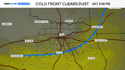
A cold front moved through Saturday, bringing only a few sprinkles and gusty northwest winds. However, it did clear out the dust from yesterday and last night.
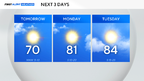
Behind the front, we'll enjoy cooler temperatures, at least for a day. DFW Airport is forecast to hit around 70 degrees on Sunday. By Monday, we're back to strong winds and temperatures in the 80s.
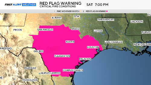
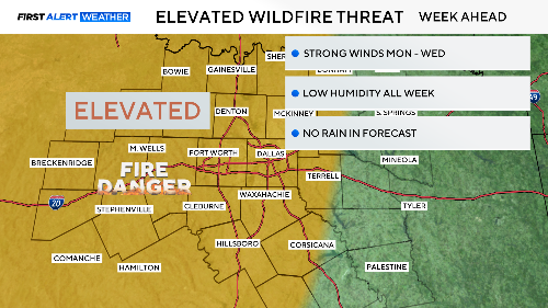
Red flag warnings were just south of us on Saturday. We could easily see these warnings return by Tuesday or Wednesday.
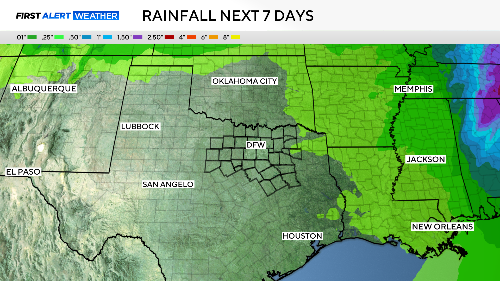
What we need is rain. What we're getting instead is dust and wind. Here is the seven-day outlook for precipitation; chances of getting some this week are not looking good.
We are expecting winds on Monday to gust up to 35 mph. On Tuesday and Wednesday, they could gust to 45 mph. Without rain in the forecast, fire danger is expected to remain elevated.
A cold front will arrive Tuesday night, bringing cooler temperatures and lower humidity. By Friday, the wind will pick up again.
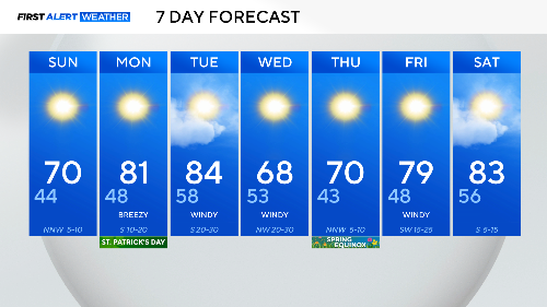
For the second March in a row, we are experiencing well-above-normal temperatures. The spring equinox arrives on Thursday. Let's hope for some spring rain to soon follow. There is a chance shaping up next weekend. We'll keep you posted and our fingers crossed.