Heat advisory issued for parts of North Texas on Memorial Day

NORTH TEXAS — Sunday was the hottest day of the year so far and within one degree of tying a record.
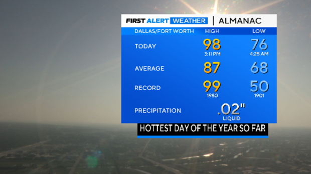
While dewpoints did come down from the near record levels Saturday, we still went into the triple-digit zone in our feel-like temperatures. The dewpoint at DFW peaked at 79° on Saturday. Sunday afternoon dewpoints were in the mid-60s.
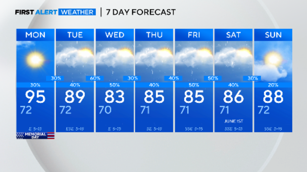
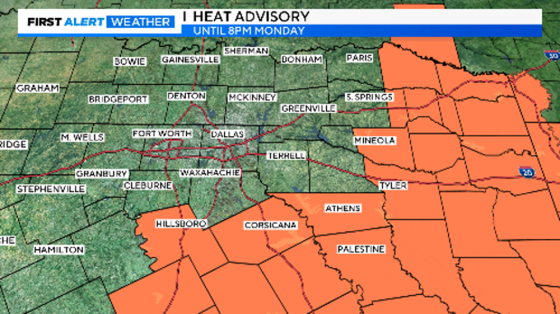
Another hot day is expected Monday. A heat advisory is in effect for our southern and eastern counties.
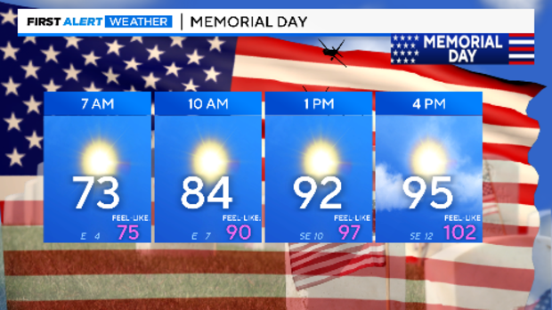
Highs will again land in the 90s with mostly sunny skies.
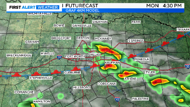
A weak front is expected to stall over North Texas overnight. After the morning patchy fog clears, storms could develop in the daytime heating. These storms could produce large hail and isolated tornadoes but coverage is expected to low, around 20%.
The better chances of storms start Monday overnight and then again Tuesday night.
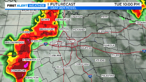
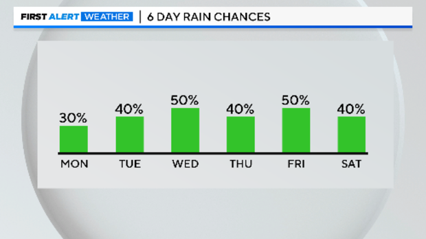
A run of more unsettled weather is expected across the week ahead. Severe storms are possible but more likely we'll again be facing flooding threats. The 7-day rainfall outlook is rather impressive as we close the month of May and Meteorological Spring.
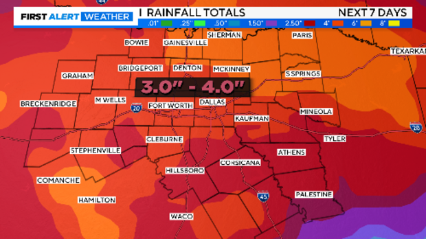
The rain chances will at least drop our highs out of the 90s. This will likely end up as a top-10 warmest May in the 124-year record.