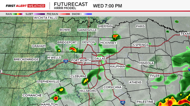
Hail, gusty winds possible with storms on Wednesday and Thursday in North Texas

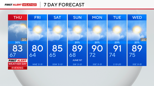
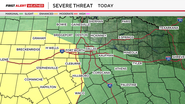
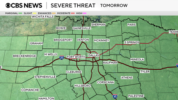
A First Alert Weather Day is in effect for Wednesday and Thursday due to the slight risk of severe storms bringing hail and damaging winds to the western and southwestern sides of North Texas.
The National Weather Service highlighted the severe threat over parts of Denton and Cooke counties, as well as Tarrant, Wise, Dallas, Parker and Johnson counties. The biggest severe threat is further west.
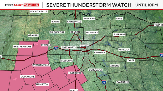
A severe thunderstorm watch is in effect until 10 p.m. for western Central Texas. Hail to 2.5" in diameter and damaging wind gusts up to 70 mph are possible. A tornado or two also cannot be ruled out.
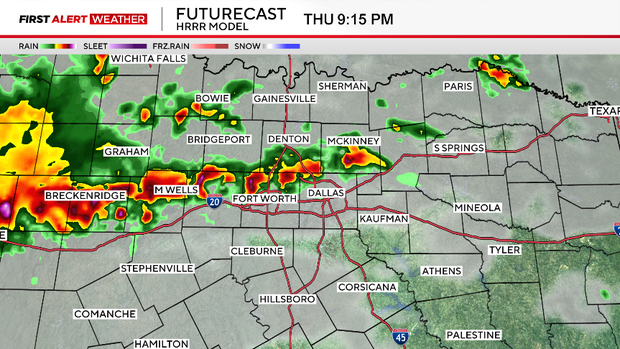
Thursday is also a First Alert Weather Day as more storms are possible along a cold front during the afternoon and evening hours.
Once again, large hail and damaging winds are the main threats.
Temperatures remain below normal for our Thursday, starting off in the upper 60s and topping out in the lower 80s.
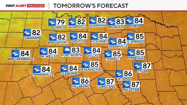
Behind the front, northerly winds will bring in drier air and lead to a beautiful Friday and Saturday.
Daily rain chances return starting Monday into the middle of next week.