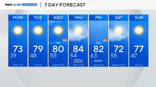
Warmer week ahead after very active weekend

After an extremely active weekend, conditions are calming down to start this next week.
Overnight, radiational cooling will take place, meaning temperatures will drop quickly, allowing for a chilly start on Monday.
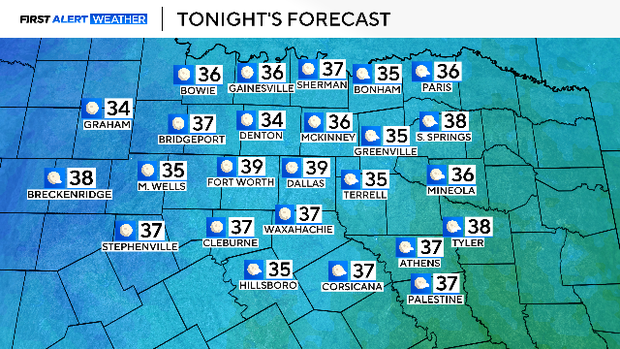
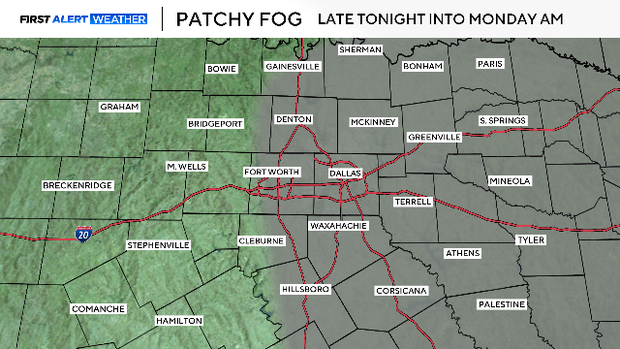
The calm winds combined with the rapidly cooling temperatures overnight will promote fog to form. The threat for patchy fog will mainly lie east of I-35 before 9 a.m. Be sure to take it slow and use low-beam headlights.
By late Monday morning, the fog will dissipate, and winds will gradually shift from the southwest, bringing dry air across North Texas. Over the next few days, dry air will encompass West Texas and cities west of I-35, increasing the threat of fire danger. Any flame that does flare up has the potential to spread rapidly.
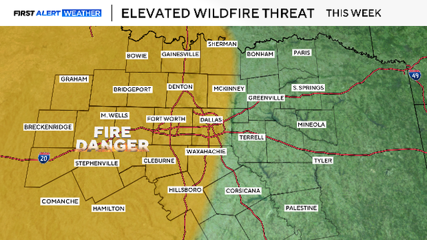
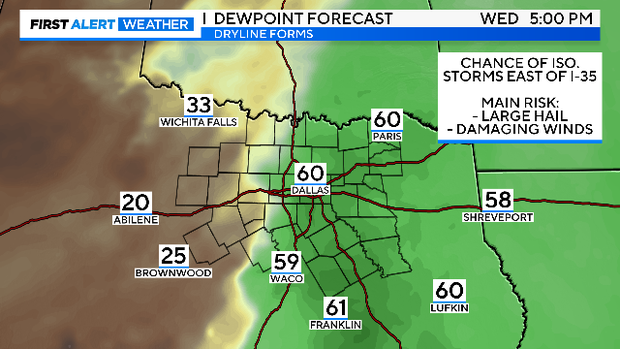
West of I-35, there will be heightened fire danger, while east of I-35, there is a threat for storms on Wednesday.
This is due to a dryline set up as well as an upper-level disturbance. Though there is still uncertainty to this forecast, now is the time to prepare for an isolated risk of hail and possibly strong winds during Wednesday afternoon.
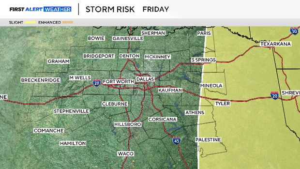
In addition to potential storm development on Wednesday for the eastern counties, there will also be another risk for severe storms on Friday evening and overnight. In fact, the Storm Prediction Center has confidence that scattered storms will take place in the areas located below:
As for the metroplex, rain chances are slim and temperatures are expected to climb well above average throughout this week. Great weather for those who are on Spring Break.