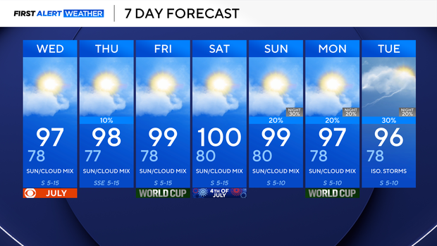
Hot, muggy and breezy conditions continue for North Texas ahead of Fourth of July

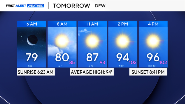
After reaching our hottest temperature so far this year on Monday, topping at 98°F, we will remain in the upper 90s Tuesday, with windy conditions at times, but that wind is getting lighter.
The highest concentration of Saharan Dust has mostly moved away from North Texas, with very light concentrations lingering over the area, which could make for instances of colorful sunsets again Tuesday evening. Continue to follow precautions for those with respiratory issues.
As we progress throughout the rest of the week, our weather will continue to be dominated by a ridge of high pressure centered over portions of the deep south, keeping our hot temperatures and humidity in place. The combination of these two will make our feels like temperatures range between 100-105°F for large portions of our area. Continue to exercise heat safety precautions as we move into the Fourth of July weekend.
By the beginning of next week, as we will be sandwiched between two areas of high pressure, this will allow for the return of very isolated chances of a shower or storm, but most of us will continue to stay hot and dry.