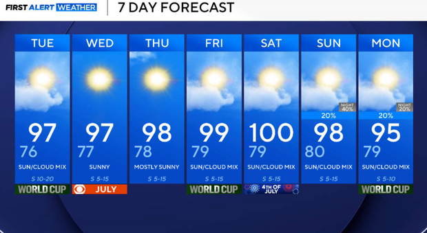
Above-average temperatures, high winds expected throughout workweek in North Texas

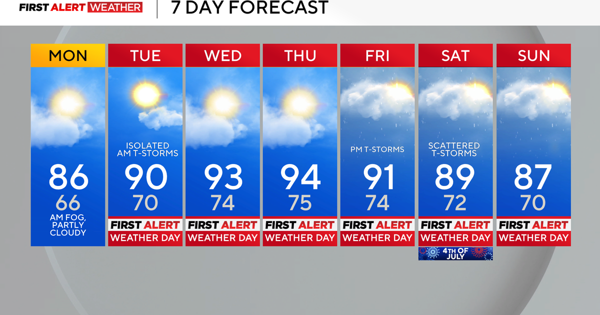
A hot and a bit hazy afternoon is in store on Monday with temperatures expected to reach the upper 90s, but a gusty southerly wind will help bring down our heat index values to just about 100°F for the majority of North Texas.
A plume of Saharan Dust has arrived in North Texas, bringing some lightly hazy skies and a colorful sunset. This plume has moved from the Sahara Desert in Africa to our region. Those with respiratory problems and sensitive groups could experience issues as our air quality degrades a bit with the dust lingering overhead.
This weather pattern will continue as we move towards the end of the week, with the ridge of high pressure just off to our east, and a trough of low pressure centered in the Western United States. This will continue our warm, humid, and briefly windy days until Wednesday, as we establish a strong pressure gradient between these two systems over our region.
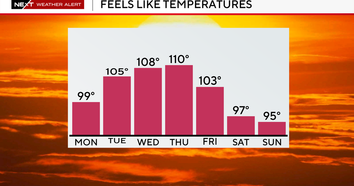
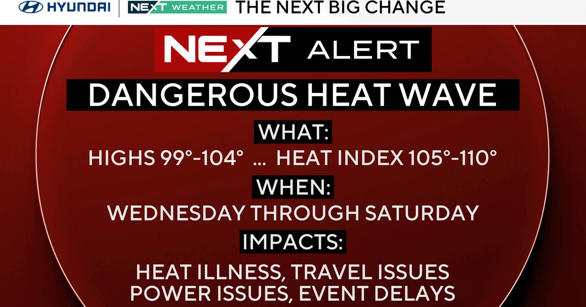
After Wednesday, this ridge of high pressure will begin to expand and slowly move off to our east, causing our winds to weaken locally, and help to push our temperatures closer to the 100-degree mark beginning this Friday, just in time for the Fourth of July celebrations. Heat index values will stay between 100-105°F throughout the rest of the week, with rain chances staying very low to none this week.
Continue to exercise heat precautions and safety when outdoors and take frequent breaks when possible.