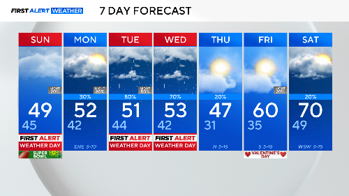
First Alert Weather Days issued for Tuesday and Wednesday: Drastic temperature drop and heavy rain expected in North Texas

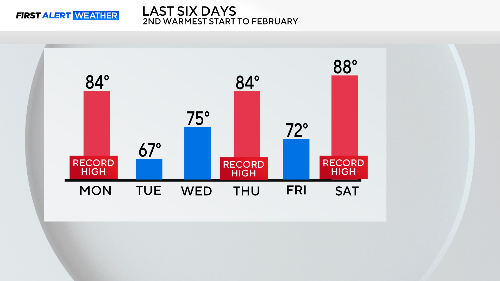
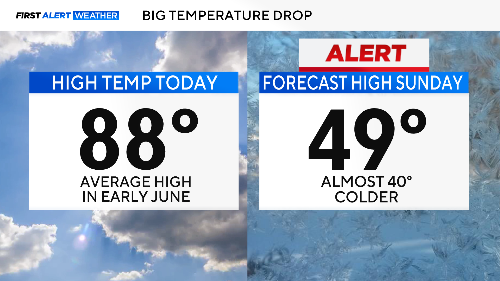
NORTH TEXAS – Saturday skipped right past spring and landed in early summer. We recorded our third record high in the last six days. It's been the warmest start to February in the past 114 years.
Then a cold front arrived just after 2 p.m., bringing us back to winter. Tomorrow? About 40 degrees colder!
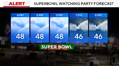
We issued a First Alert Weather Day to ensure you aren't surprised when we jump back two seasons in 24 hours. Indoors will be the place to be tomorrow for your Super Bowl watch party.
There could be some drizzle, especially in the morning. We have another First Alert Weather Day on Tuesday for a cold, steady rain.
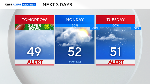
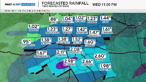
Another wave of rain will arrive late Tuesday night into Wednesday morning. Another First Alert Weather Day is issued for Wednesday.
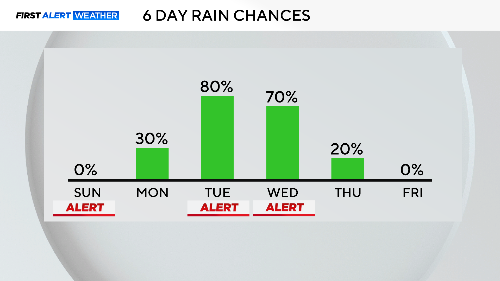
No severe weather is expected, but there could be some strong storms on Wednesday just south of the Metroplex. Heavy rain is the main threat, with some areas potentially receiving close to 3 inches of rain over the two days.
All the warm weather last week will be a distant memory this week. It will get warmer as we head into the weekend but don't expect to see highs in the 80s again anytime soon.