Excessive Heat Warning in effect for much of North Texas through Thursday
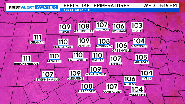
NORTH TEXAS (CBSNewsTexas.com) – Today is a Weather Alert! Feels-like temperatures have already risen into the triple digits today in the Metroplex, and even hotter weather is in store through the afternoon.
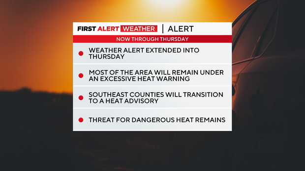
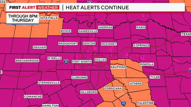
An Excessive Heat Warning remains in effect for North Texas through 8 p.m. Wednesday. Feels-like temperatures could get as high as 113° this afternoon in several communities.
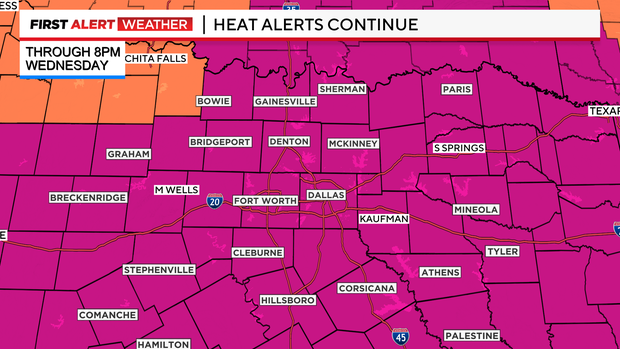
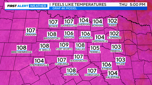
After 8 p.m., some counties to the southeast will transition to a Heat Advisory through 8 p.m. Thursday, while others will remain under the Excessive Heat Warning.
Remember to protect you and your family from this dangerous heat. Drink plenty of water, take breaks while outdoors and check on your pets and elderly neighbors.
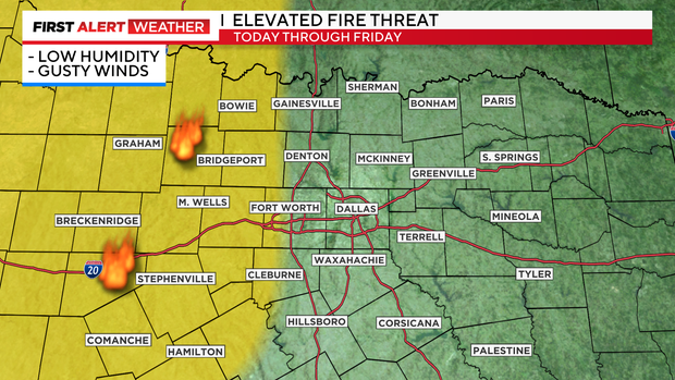
We'll see sunny skies today, which means an elevated fire risk is posted for parts of North Texas. In fact, an Elevated Fire Threat is in effect for areas along and west of I-35 this afternoon through Friday afternoon due to the continued dry, hot conditions and gusty winds up to 20 mph. Outdoor burning is not recommended.
Thursday will be another hot one. High temperatures will be around 104°. Feels-like temperatures will be around 108°. Heat alerts are likely.
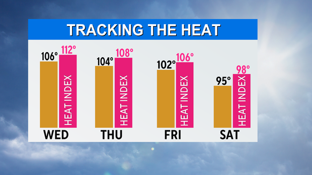
Friday will have highs around 102° under partly cloudy skies. Heat index values will be around 106° by afternoon.
This weekend, we'll get a brief break from the extreme heat.
A weak cold front will sink into the area Saturday, giving way to slightly "cooler" weather. Highs will drop into the mid 90s. An isolated shower or storm is possible Saturday, but we're not expecting a washout. The chance for rain is at 20%.
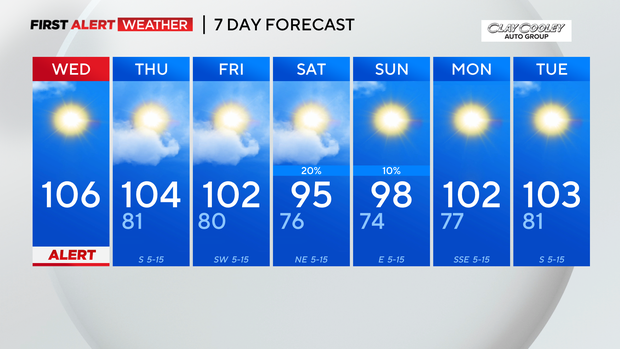
On Sunday, an isolated shower or storm is possible, but most areas will be dry. High temperatures will be in the upper 90s.
By Monday, highs will be back into the triple digits.