Warmer temperatures, elevated fire danger expected for North Texas


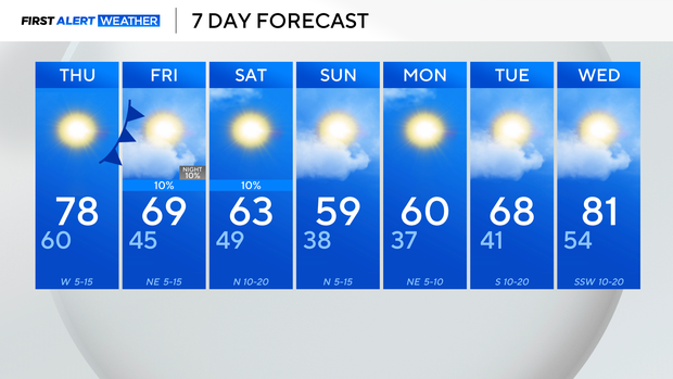
It was another warmer-than-average day across North Texas, with temperatures topping out in the 70s and even the 80s for those further west. Once the sun sets, temperatures will cool, eventually dipping into the 60s.
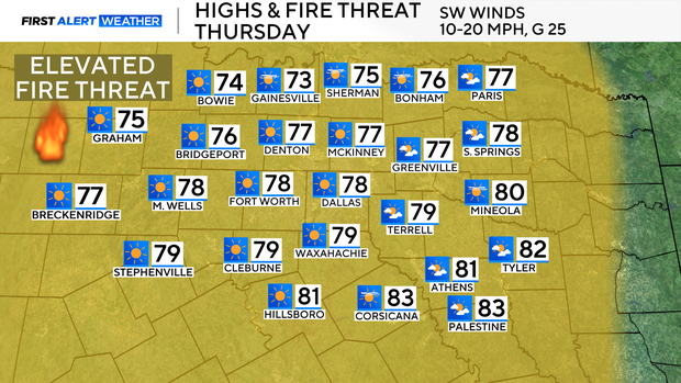
Low relative humidity, warmer-than-average temperatures, and breezy winds are back in the forecast for Thursday. Temperatures will start in the 60s and climb into the upper 70s by the afternoon. Expect an abundance of sunshine and gusty winds from the southwest.
Due to the atmospheric conditions, high fire danger will encompass the area. Please avoid any activities that may cause a spark or a flame.
A cold front will move through at the end of the week which will bring a cool down for the weekend. Rain chances are nominal, but a storm is still possible to the east of I-35 on Saturday.
Seasonal and dry air is back in the forecast for a pleasant end to the weekend and start to the next work week.