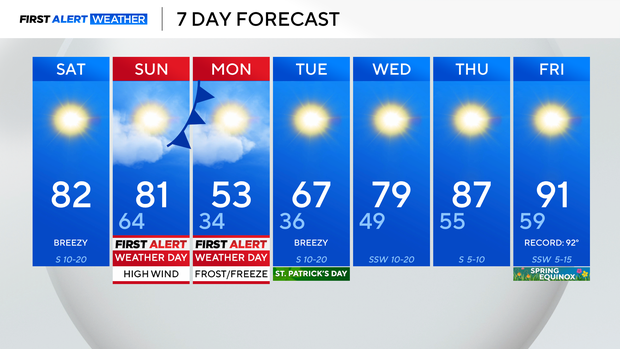
Temperatures to hit 80s ahead of cold front bringing high winds, fire danger Sunday

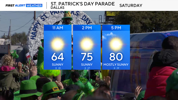
Whether going to the Grand Prix or the St. Patrick's Day Parade in Dallas, it will be a fantastic day to get outside.
There will be an abundance of sunshine, and temperatures will climb into the low 80s on Saturday afternoon. Winds will stay breezy, gusting up to 25 mph at times.
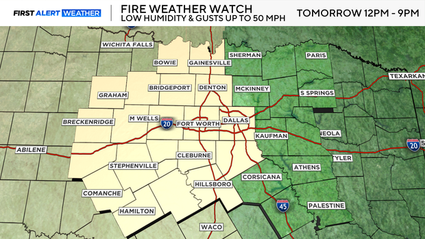
Sunday morning will start warmer than average in the mid-60s with a breeze from the south. Temperatures will rapidly climb into the 80s by the late morning and early afternoon. However, a powerful cold front will swing through the area after lunchtime, bringing gusty winds up to 50 mph and dipping temperatures in the late afternoon.
The winds, combined with warmer-than-average temperatures and low relative humidity levels along and to the west of the I-35, will lead to high fire danger. A fire weather watch is in effect Sunday from noon to 9 p.m. Please avoid any activities that may cause a spark or a flame.
Sunday will be cloudy and stay dry for most of North Texas, but there is a potential for rain and even severe weather in East Texas. Storms will fire up in the afternoon ahead of the front.
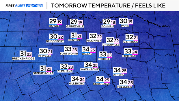
The front will usher in a cold airmass, and temperatures could reach freezing on Monday morning. However, Monday will stay windy, meaning temperatures will feel more like the 20s and teens. Be sure to bundle up and protect any sensitive vegetation.
It will be a cold rest of the day on Monday, but luckily temperatures quickly rebound for St. Patrick's Day. A near record high is in the forecast on Friday, the first day of the spring equinox.