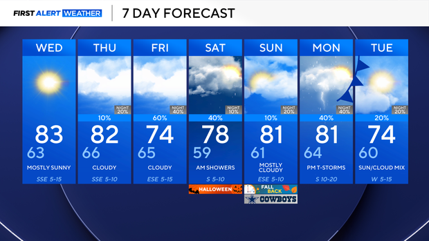
Rain chances to return Halloween weekend as temperatures remain in 70s, low 80s


Tuesday has shaped up quite nicely, weather-wise, across North Texas. Once the sun sets at 6:42 p.m., temperatures will dip into the 70s, with a mild southeast wind around 5 to 10 mph.
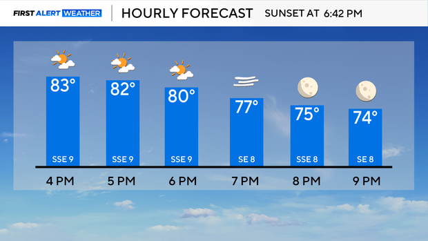
Wednesday morning will be mild, once again. Lows across the area will range from the upper 50s to the low 60s. However, temperatures will climb throughout the day, and highs will reach into the low 80s in the afternoon.
Expect sunshine with a few clouds and winds from the southeast at 10 to 15 mph, gusting up to 20 mph, on Wednesday afternoon.
Rain is forecast this week as a subtropical jet combines with remnant moisture from Vance, the tropical system currently in the eastern Pacific. Showers and storms will be possible as early as Thursday for counties west of I-35, and more activity will be likely Friday and even Saturday through the afternoon.
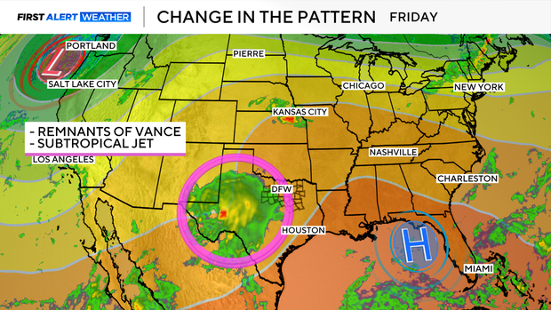
Forecast models are indicating the biggest rain event will occur on Friday. However, models are still somewhat inconsistent on the timing of the rain on Saturday, which is Halloween.
As of now, rain does look to move out of the area in time for the trick-or-treaters.
The rain-cooled air and cloud cover should keep highs in the 70s on Friday and Halloween. The next front isn't expected until early next week, that's when the next cool down will be expected. Stay tuned because the forecast models are subject to change.