Flooding threat lingers in North Texas Sunday before heat returns

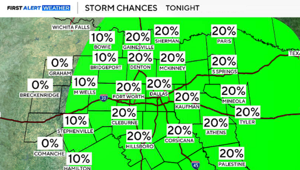
On Saturday, the DFW Airport recorded 1.04 inches of rainfall, and heavy rain fell overnight. Grounds are already saturated, leading to flooding in low-lying areas across parts of North Texas.
More heavy rain is expected on Sunday, especially in areas east of the I-35 corridor.
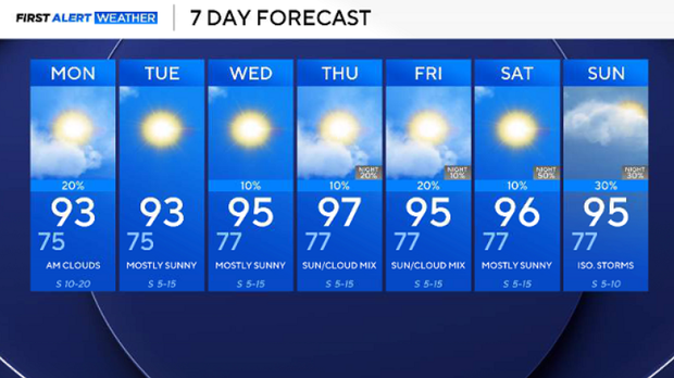
Sunday will be cloudy with winds from the south gusting up to 25 mph. Expect temperatures to climb into the low 90s, with a heat index or feels-like value in the upper 90s by the afternoon. Drink plenty of water.
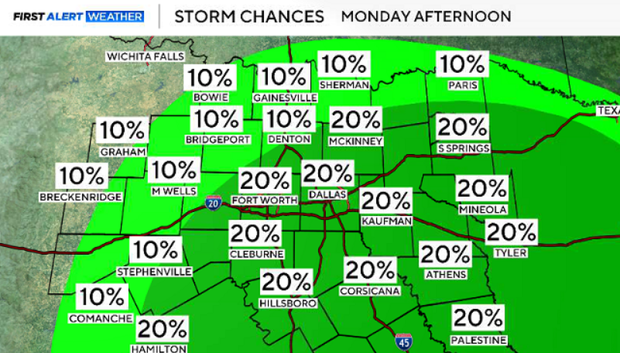
On Monday, there will be a chance for additional storms in the afternoon. By the evening, conditions will be clear. Skies will be mostly sunny, and temperatures will be in the low 90s.
Next week, a high-pressure system will build, allowing for conditions to heat up and the sun to shine. Highs will climb into the mid and upper-90s by midweek. Heat index values will be around 100 degrees, and winds will be breezy from the south.
The next chance of rain will be Thursday or Friday, associated with a front; the timing and precipitation chance are still being ironed out.