Warm, breezy weekend expected as possible strong, severe storms head to North Texas next week
Good morning, North Texas!

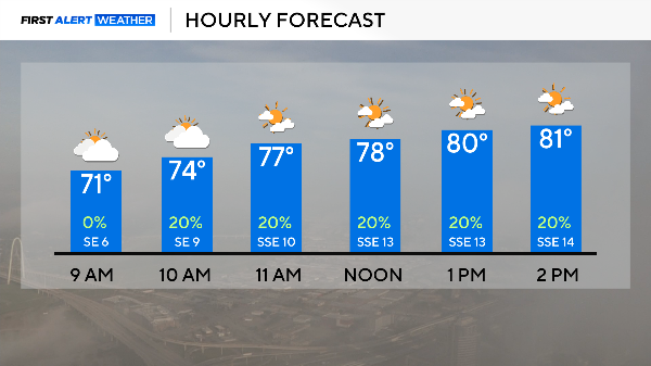
Saturday started with a little patchy, but it will continue to lift out over the next couple of hours.
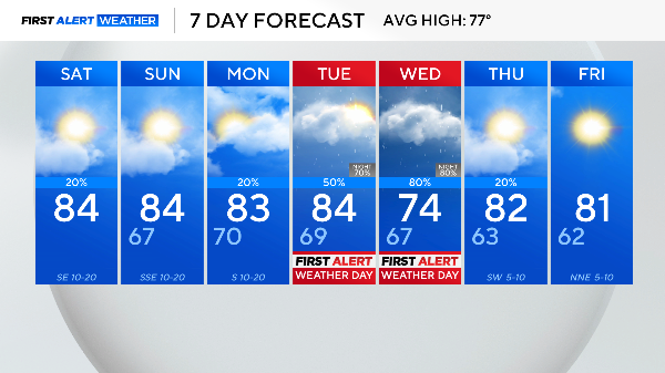
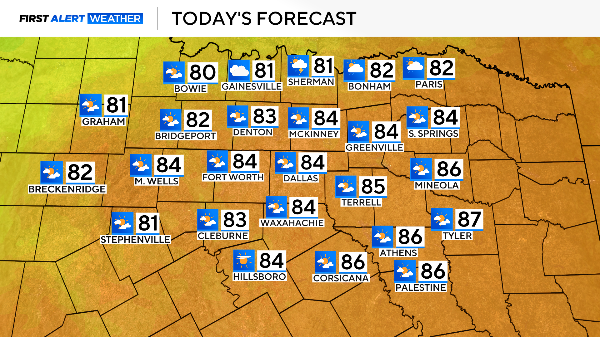
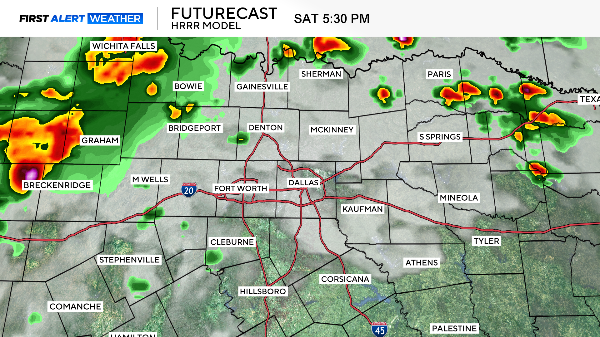
Most of North Texas will remain dry Saturday with partly cloudy skies and highs in the low to mid-80s.
A complex of storms developed in the panhandle overnight and is tracking along the Oklahoma border. It will continue to head east/southeast over the Red River.
An isolated severe storm with hail, gusty winds, and heavy rainfall is possible.
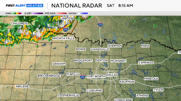
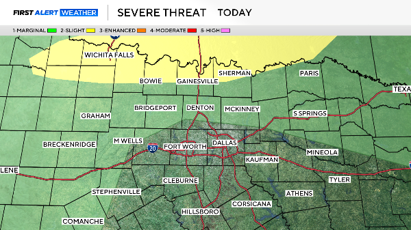
While widespread storms are not expected Saturday, a few storms may develop during peak heating in the afternoon.
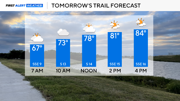
Sunday is shaping up to be great! It will be a warm, humid and breezy day with highs in the mid-80s.
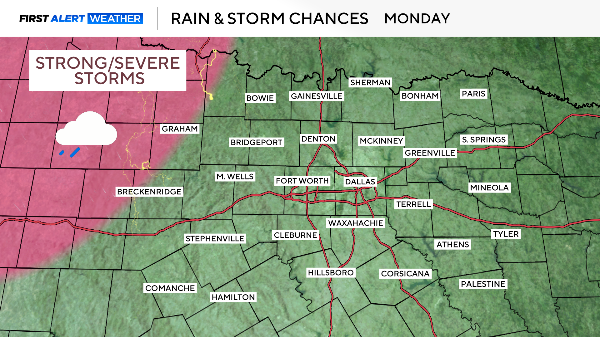
The pattern begins to shift on Monday. While the Dallas-Fort Worth metroplex will remain dry, far western counties may see storms in the evening hours.
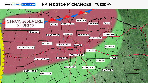
First Alert Weather Days have been issued for Tuesday and Wednesday as the severe threat increases in North Texas.
All hazards are possible, including large hail, damaging winds, flooding and tornadoes.
The dryline that has remained out to our west will be shifting eastward next week.
As the dryline is inching closer to North Texas, a front will be sliding in from the north, both may serve as initiation points for storms in the afternoon and evening hours.
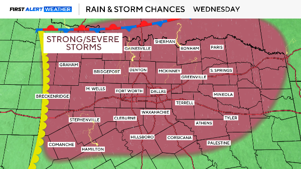
Wednesday, the dryline continues to move closer into our far western counties.
North Texas will be sitting in the warm, humid airmass ahead of the dryline and south of the front, in an area prime for severe weather.
A disturbance will also be passing overhead on Wednesday, increasing the severe threat, including the risk of tornadoes.
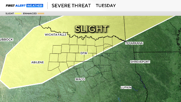
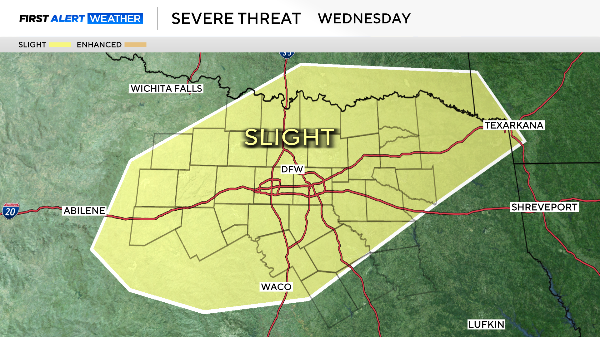
The Storm Prediction Center has already highlighted North Texas in the "Slight Risk" for severe weather both Tuesday and Wednesday.
Please stay up to date on the forecast for the latest on timing and have your severe weather plan in place.
Enjoy Sunday and Monday when we get a brief reprieve from the stormy weather.