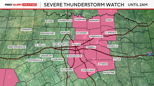
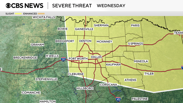
Severe thunderstorm watch continues until 2 a.m. for areas east of Dallas

Areas east of Dallas remain under a severe thunderstorm watch until 2 a.m.
Meanwhile, after the clouds cleared, Saturday was a beautiful day with high temperatures warming into the mid-80s.
DFW recorded a high temperature of 83 degrees.
We have a First Alert Weather Day in place for Sunday afternoon into the early evening hours.

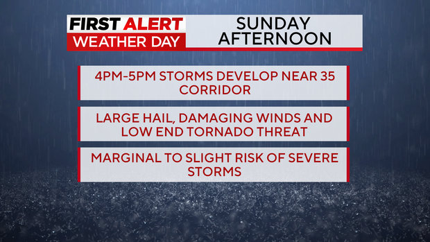
A dry line moving east, along with a cold front from Oklahoma, will create favorable conditions for strong to severe storms to develop near the I-35 corridor between 4 and 5 p.m. on Sunday.
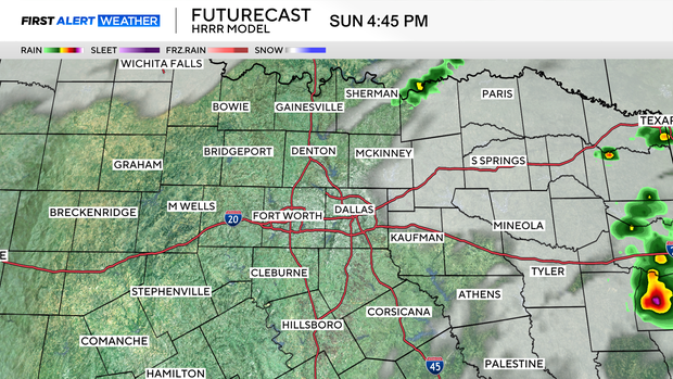
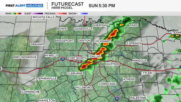
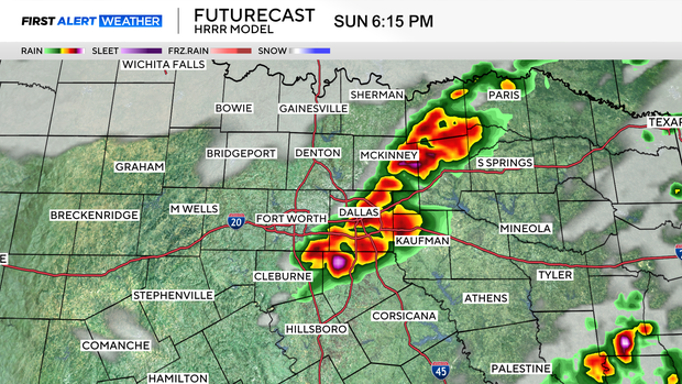
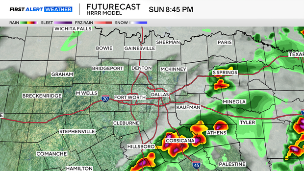
Large hail, damaging winds, and a low-end tornado threat are possible as these storms develop. They will move south and east as the cold front continues through North Texas. There is a marginal to slight risk of severe storms in North Texas for tomorrow afternoon into the evening hours.
After that, we will have cooler temperatures on Monday under mostly sunny skies, with a high of only 70 degrees. Tuesday into Wednesday, rain and storms return to the forecast.
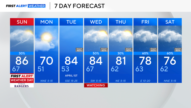
We're watching Wednesday for a potential first alert weather day. There is a 50 to 60 percent chance of strong to severe storms developing, with a chance of storms continuing into the weekend.
Have a great night!


