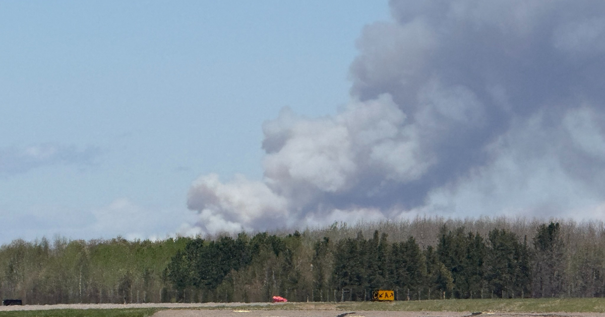
Dry and breezy conditions ahead for North Texas with an elevated fire risk


Parts of North and Central Texas dealt with a couple of severe thunderstorm warnings Wednesday evening, bringing quarter-sized hail and winds as high as 60 mph as a dryline advanced through the region. Fortunately, a cap held in place for most of North Texas, which really limited thunderstorm development for the rest of the region.
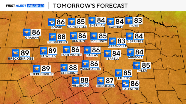
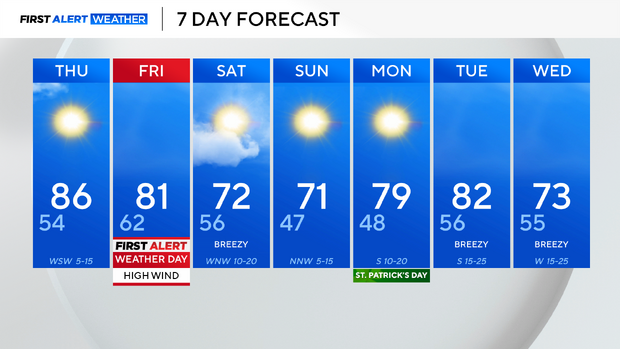
As we head into Thursday, it will be a dry day for the area, with highs in the middle 80s and breezy conditions.
An elevated fire threat remains in place for Thursday, with that breeze and with very low relative humidity.
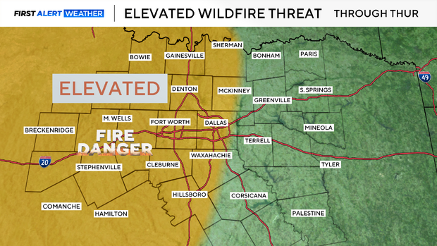
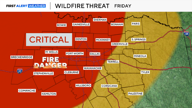
That elevated fire threat turns critical on Friday as a low-pressure system moves through the Central Plains, ramping up our winds in North Texas.
Sustained winds in the 20-35 mph range are expected, with gusts of 50-60 mph.
A Fire Weather Watch is in place for that critical fire threat. If fires do start, they'll have the ability to spread very rapidly.
A cold front sweeps through Friday into Saturday, dropping temps back into the lower 70s for the upcoming weekend.
We start warming back up next week.
What is a red flag warning?
According to the National Weather Service, a red flag warning means that extreme fire weather conditions are occurring now or will shortly. A combination of strong winds, low humidity and dry vegetation can contribute to an extreme fire risk.
The NWS recommends to avoid all outside burning and welding, do not toss lit cigarette butts outside and to report wildfires to the nearest fire department or law enforcement office.