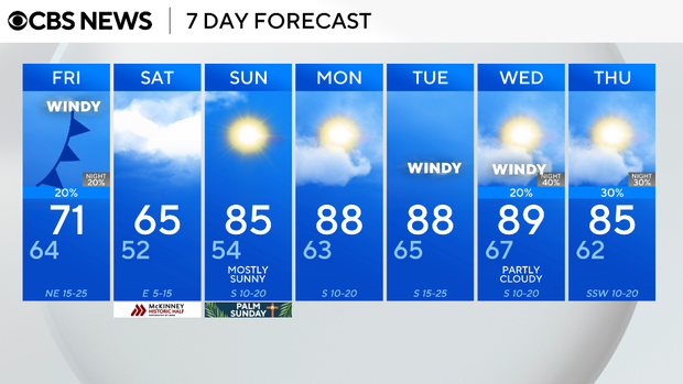
Warm weather continues for North Texas on Thursday before cold front brings winds, drop in temperatures

Thursday evening will be mild and windy. The wind will be coming in from the south, gusting between 20 and 25 mph. Expect mostly clear skies with lows in the low 60s.
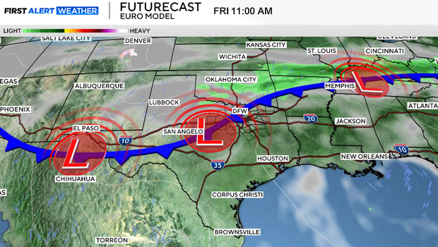
Friday starts warm with mostly sunny skies in the morning, but changes arrive around midday. A cold front will move through between the late morning and the early afternoon, shifting winds from the south to the northeast by the evening. It will stay windy behind the front, with gusts reaching 30 to 35 mph in some areas.
Clouds will increase through the afternoon, and while most spots stay dry, there's a 10–20% chance for a few light sprinkles or brief showers along the front and behind it.
If you're heading out Friday evening, it's going to feel very different compared to earlier in the day. Temperatures will be falling into the low 60s and high 50s by around 8 p.m., with mostly cloudy skies and breezy conditions.
Saturday will be a cloudy, cool and breezy day, with highs only reaching around 66°. The cool down will not last very long.
Sunday starts with a few clouds, but we'll see sunshine return by the afternoon. Highs will climb to around 85°, well above the average of 73°.
Monday stays warm with highs near 88° and partly cloudy skies, and Tuesday looks similar.