Partly sunny skies, high temps on deck as storm chances increase mid-week in North Texas

Monday will have the same weather that North Texas had on Sunday: lots of clouds and humidity, breezy and warm. Kids will head to school with cloudy skies and temperatures in the upper 60s.

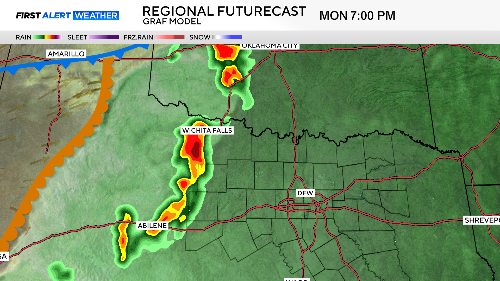
We'll watch the dryline to our west Monday afternoon for thunderstorm development. These storms could produce large hail and damaging winds. They'll make a run into our western counties as they weaken Monday night.
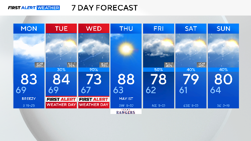
Tuesday and Wednesday are First Alert Weather Days as the threat of storms increases across the area.
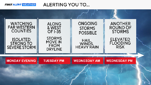
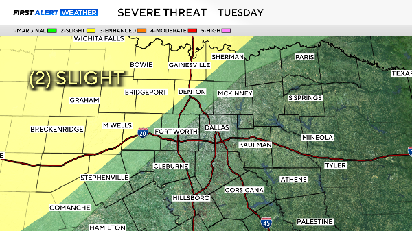
The latest update on the severe weather outbreak we expect Tuesday and Wednesday centers on Tuesday afternoon. The threat will be confined to our northwest.
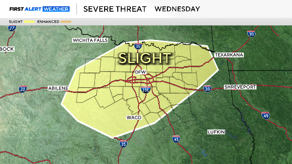
Some of these afternoon storms could move into the metroplex Tuesday evening, but will likely weaken some. Severe weather is still possible, likely in the form of 1" hail and 60mph wind gusts. Wednesday looks to deliver the most widespread severe weather and heavy rain.
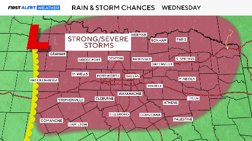
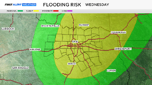
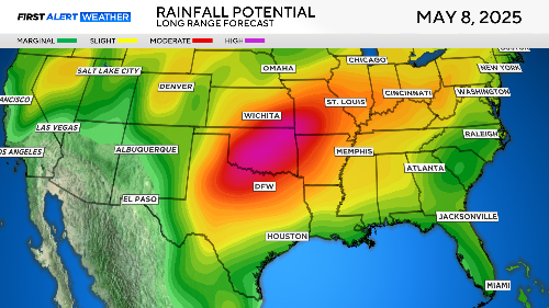
Some of our areas could get 3" – 4" of rain over the two-day period, with most of it coming on Wednesday. Flooding is a big concern; please never drive into a water-covered road.
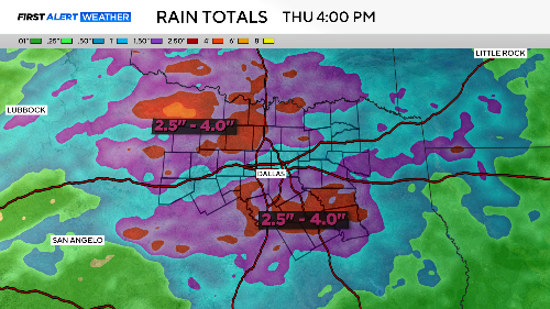
This is going to be the start of another run of wet weather that could go on for another week. The long-range precipitation outlook shows significant rains over North Texas and the Southern Plains.
Here is your seven day forecast. Notice that rain/storm chances stay around for next weekend.