Flood watch in effect as new round of scattered storms, rain expected to hit North Texas

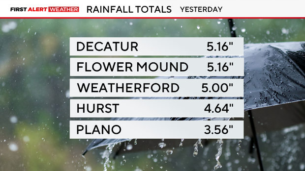
DFW Airport received 3.10 inches of rain on Friday, which drenched the previous daily record of 2.76 inches that was recorded in 1949. Other locations across North Texas got over 5 inches.
The month of October has been exceptionally dry. DFW Airport was in a deficit of over 3 inches, but thanks to Friday's downpours, October is now near normal precipitation-wise.
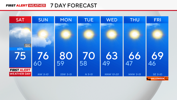
More rain is on the way on Saturday. A low-pressure system will slowly move eastward, which will spark up additional showers and storms by the afternoon. A few isolated stronger storms are possible, but the main concern is flooding.
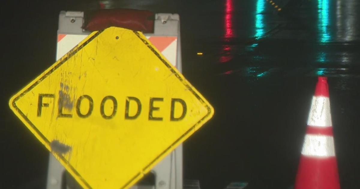
An additional 1 to 2 inches of rain is possible for some areas, which could lead to flooded roadways. A flood watch is in effect until 10 p.m. for areas along and south of I-20. Please never drive through flooded roadways.
On Sunday, conditions will clear. Only counties to the northeast of the metroplex will have the potential for a few showers.
After a brief warm-up into the 80s on Monday, it will finally get cooler for North Texas for the rest of the week. There will be two fronts that will knock temperatures down at the beginning of the week. The lows by Wednesday morning will be in the 40s and the highs in the 60s.
As of now, Halloween is expected to be spook-tacular weatherwise... stay tuned.