Severe storms push through North Texas Sunday, producing tornadoes and damaging winds


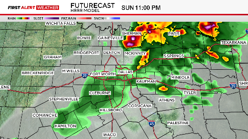
Another round of potentially severe storms is expected Sunday evening.
A flash flood warning is issued for Denton County until 12:30 a.m.
Multiple funnel clouds were spotted by CBS News Texas Storm Chaser Jason McLaughlin in Palo Pinto County and there has been confirmation of a tornado over Strawn.
Please have multiple ways to receive warnings and be prepared to act quickly if a warning is issued for your area.
Storms will likely still be ongoing near the Red River after sunset before ending around midnight.
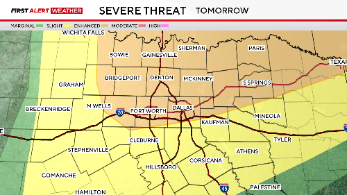
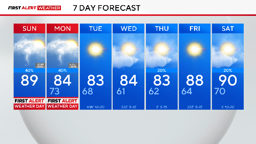
Monday is also a First Alert Weather Day due to the potential of another round of severe storms.
The Dallas-Fort Worth Metroplex has been upgraded to a Level 3, Enhanced Risk for storms Monday afternoon into the evening hours.
Please remain weather aware as all modes of severe weather are possible, including tornadoes.
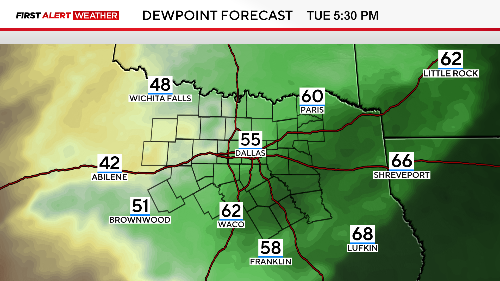
Late Monday into early Tuesday morning, a cold front will move into North Texas, bringing a welcome drop in humidity.
Drier air will settle in on breezy northwesterly winds, lowering dewpoints into the 50s!
For reference, dewpoints have been in the 70s for the past few days, so it is going to feel wonderful!
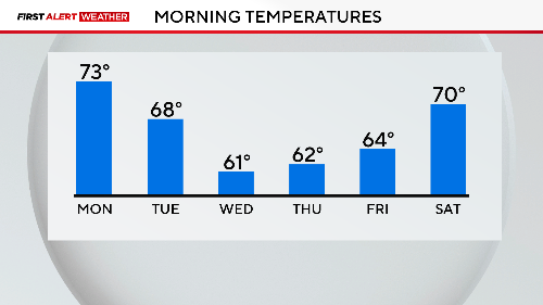
That drier air also means some cooler mornings on Wednesday and Thursday when you wake up to the 50s and lower 60s.
Enjoy a break from the storms Tuesday and Wednesday, but a quick-moving disturbance could produce a few showers Thursday evening.
Temperatures will gradually warm back above normal heading into next weekend.
Remember, you can always tune into the CBS News Texas stream for extended coverage during severe weather.