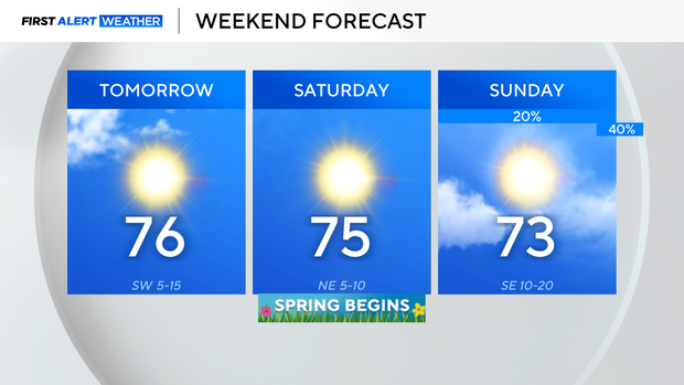
North Texas will be warm and sunny heading into the weekend

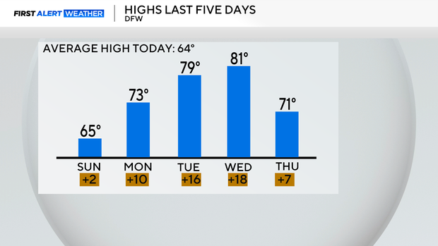
Despite a cold front moving through Wednesday, the high at DFW today was still 7° above normal.
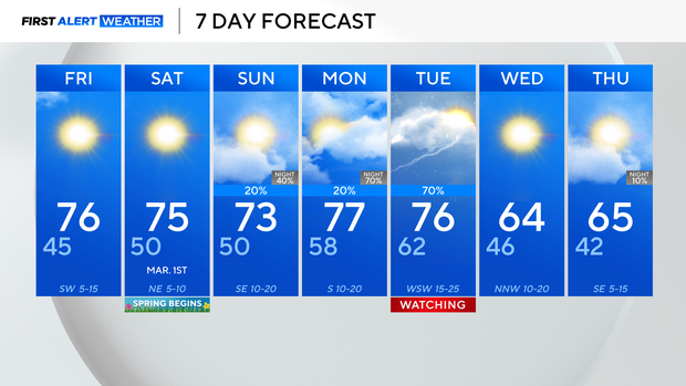
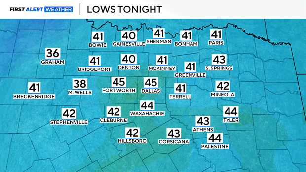
It will be a chilly morning on Friday, thanks to clear skies and calm winds. DFW should drop to near 45°, but some could be in the upper 30s briefly.
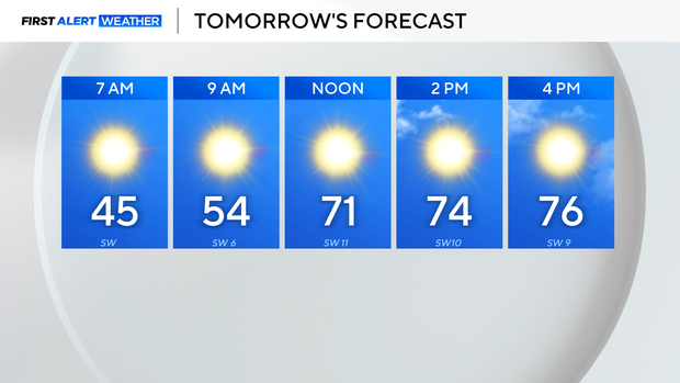
It will be a very pleasant Friday, with sunny/mostly sunny skies and highs in the mid-70s.
This trend of pleasant, spring-like weather will continue into meteorological spring.
Clouds will increase on Sunday, and a few showers will be possible Sunday evening, but the concerning timeframe for rain and storm will be overnight Monday into Tuesday.
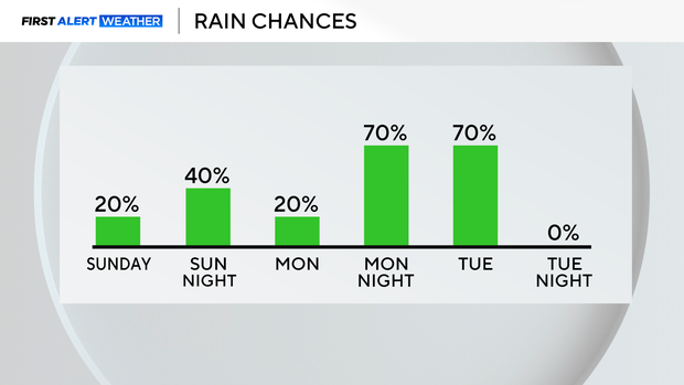
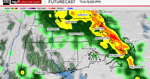
The Storm Prediction Center is already highlighting parts of North Texas for the threat of severe weather on Tuesday. Notice the trend from Wednesday to Thursday, shifting the threat to the west and now including some of our most eastern counties under the enhanced risk.
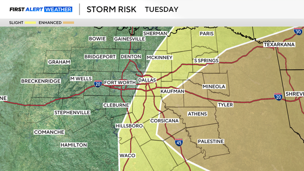
For now, we are watching Tuesday for a potential First Alert Weather Day. There are still a lot of details to figure out, but it does look like some stronger storms will be possible.