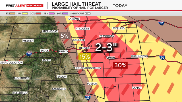
Very large hail possible as severe storms threaten Front Range, Eastern Plains
Colorado's biggest severe weather threat on Tuesday is hail as parts of the Front Range and Eastern Plains are under an Enhanced Risk for severe weather.
Watch CBS News

Colorado's biggest severe weather threat on Tuesday is hail as parts of the Front Range and Eastern Plains are under an Enhanced Risk for severe weather.
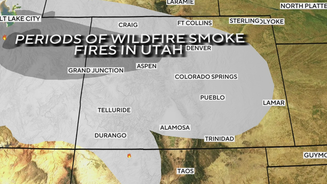
Several rounds of wildfire smoke will move across Colorado this week, bringing hazy skies, reduced visibility and periods of poor air quality.
Colorado is locked into an active stretch of weather, with severe storms possible across the Front Range and Eastern Plains before heat and fire danger builds this weekend.

Colorado has been using cloud seeding as far back as the 1950s, but an all-new weather modification project in Colorado is taking shape on the Eastern Plains.

The hottest temperatures of the year are expected across Colorado on Wednesday, with widespread 90s and several areas potentially reaching triple digits.
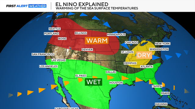
El Niño does not guarantee that it will happen. It just opens the door.
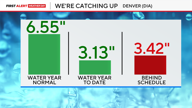
Denver is heading into its wettest stretch of the year, but the city is not just looking for normal moisture from here on out. It needs extra moisture to make up for what was missed during the winter and early spring.
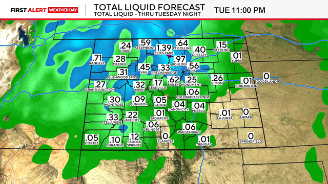
A spring storm is bringing a soggy and cool start to the week across Colorado, with rain for the lower elevations and accumulating snow in the mountains and upper foothills.
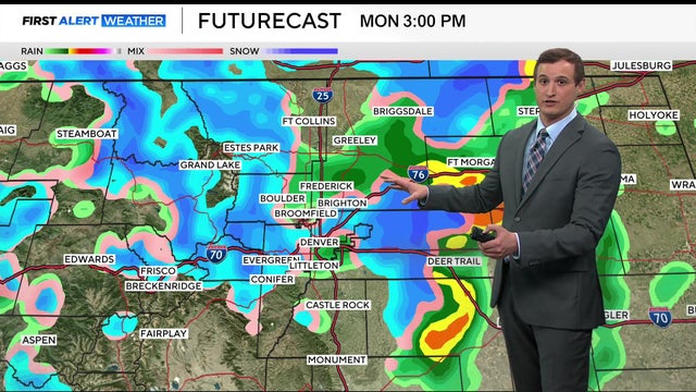
A spring storm will bring a sharp split in Colorado's weather on Monday, with rain expected in Denver and along the lower I-25 corridor while accumulating snow falls in the mountains and upper foothills.
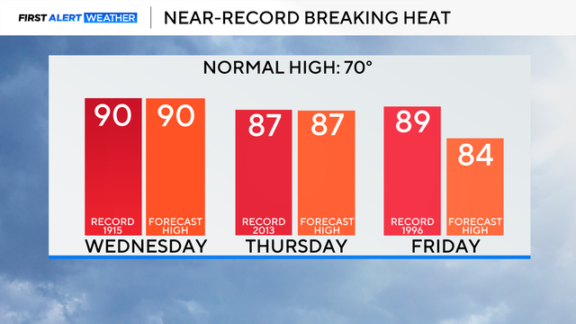
Wednesday could also tie the daily record high for May 13. The current record is 90 degrees, set in 1915.

A stronger and wetter storm will move into Colorado Monday night through Wednesday, bringing widespread precipitation and an increasing chance for accumulating snow along the Front Range and I-25 corridor.
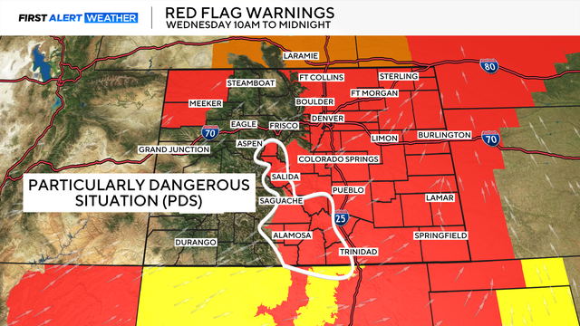
That designation means fire weather conditions are about as extreme as they can get in the outlined areas.
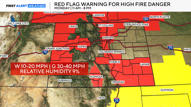
The bigger concern is what comes with the warmth: low humidity and gusty winds developing late Monday morning. That combination can turn a small spark into a fast-moving fire.
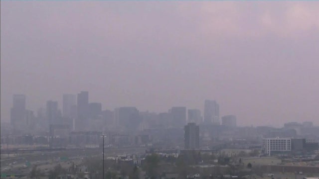
Some people who live in the Denver metro area on Thursday afternoon were making calls to 911 after skies became noticeably hazy.
That means Denver has now broken its all-time March heat record twice in less than a week.