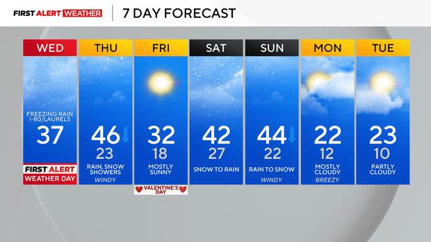
Snow to rain today in Pittsburgh, freezing rain on I-80 and Laurel Highlands | First Alert Weather Day

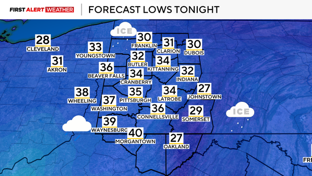
PITTSBURGH (KDKA) - We continue our active saga of weather across Western Pennsylvania and Northern West Virginia. System one from earlier this week is departing this morning, but the second storm is right on its heels and we'll begin to see its impacts later this afternoon and this evening. This morning, there are some remnant areas of light to moderate snow moving across the southern half of our area, generally from Pittsburgh, south as some warmer air aloft moving into the region generates lift. With this warmer air moving in aloft, we also expect this to translate to surface temperatures as well, so while we are below freezing this morning, temperatures here locally will climb back into the low-mid 30s by early to mid afternoon.
WEATHER LINKS:
Current Conditions | School Closings & Delays | Submit Your Weather Photos
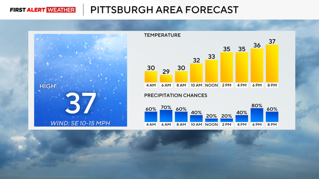
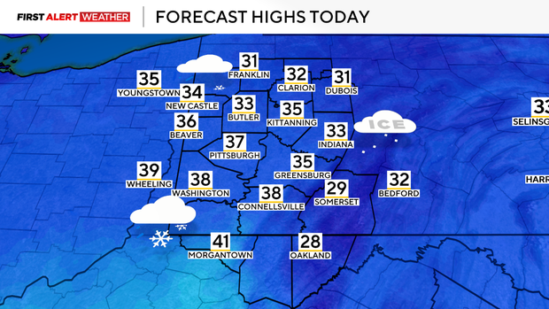
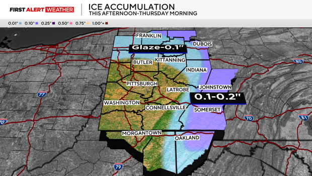
The second storm system out to the west in the Plains will begin to move closer to the region by this afternoon and evening. Most folks will see rain from Route 422 south and west of the Laurel Highlands and Ridges. However, where shallow low-level cold air is concentrated, there will be some light freezing rain. The best chance of seeing freezing rain will be between roughly 3 p.m. this afternoon through 3 a.m. Thursday north of Route 422 and in the eastern sides/valleys of the Laurel Highlands and Ridges. Between a glaze to 0.2 inches of ice is possible. All other areas in our coverage area will see rain as warm air surges into the region.
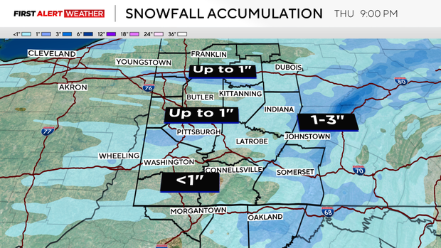
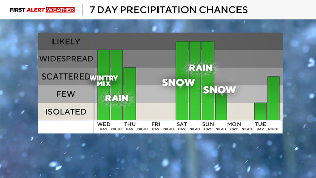
Once the surface low and cold front pass through the region on Thursday morning, expect falling temperatures and strong wind gusts through the day. Winds will gust out of the west up to 30-40 mph. Some rain showers are likely in the morning, followed by scattered snow showers in the afternoon. Total snow accumulations from Wednesday morning through Thursday night will be 1 inch or less in most spots. Temperatures will peak in the low-mid 40s just after sunrise, then fall into the low 20s late in the evening. On Friday, high pressure settles into the region with clearing skies and seasonably cold temperatures. This high will quickly move to the east on Friday night as another powerful low pressure gears up to the southwest and moves toward the Ohio Valley and Lower Great Lakes by Saturday and Sunday. Precipitation types will vary this weekend, likely starting with snow Saturday morning, shifting to rain Saturday afternoon and night, then switching back to snow as the cold air moves in on Sunday afternoon. More details on this weekend's system in the coming days.
Stay up to date with the KDKA Mobile App – which you can download here!