Pittsburgh Weather: Temperatures Approach 60 Degrees, But First Alert Day Ahead Thursday
PITTSBURGH (KDKA) -- Enjoy today with high temps near 60 with a strong southerly flow.
Wind gusts will peak near 30 mph through the day with mostly cloudy skies.
Thursday is a different story.
Alert: Thursday evening and Friday morning/afternoon we are looking at potential flooding for areas north and west due to heavy rain and a rumble or two of thunder. Rainfall amounts will be around 1" for many locations so river flooding is an issue especially with melting Wednesday and ice jams. Rain switches to a mix then snow showers for Friday morning but minimal accumulation is expected.
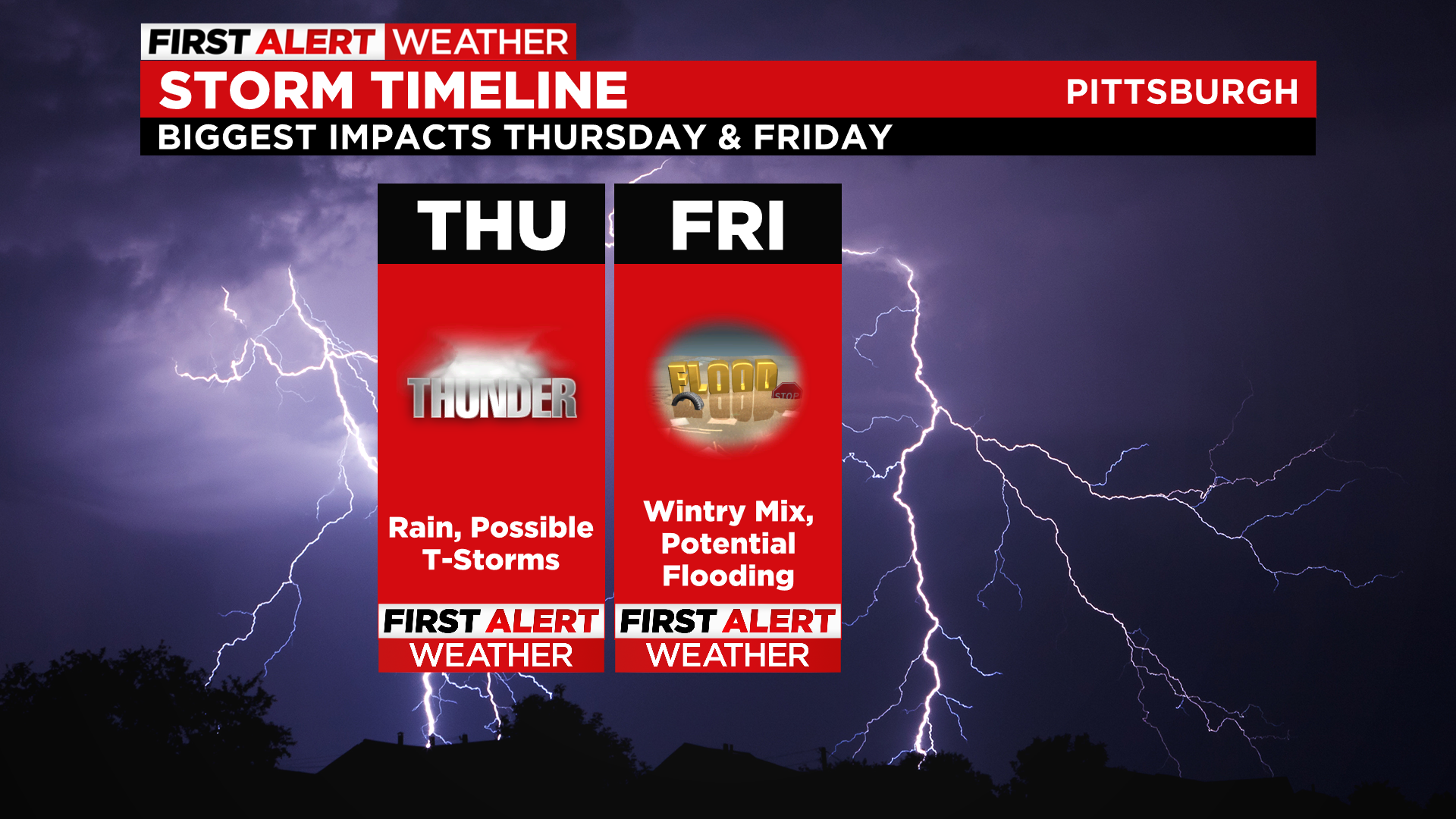
We are declaring First Alert Days beginning Thursday and into Friday. We want you to be informed and to know that you need to be prepared for weather that could cause some commuting issues Thursday evening and/or Friday morning.
WEATHER LINKS
Current Conditions | School Delays & Closings | Local Radar | Weather App | Photos
Thursday highs will be at or near 60 again but a front moving through the region, then stalling out will produce a soaking rainfall for the evening commute. A Flood Watch for Beaver, Butler, Lawrence counties, as well as areas along I-80, is expected to start at 10 a.m. Thursday and go until 7 a.m. Friday.
Temperatures will fall Friday back around freezing and we will see snow showers so watch for slick spots but again, the biggest impact is potential flooding. Saturday will be chilly with a few scattered snow showers and then sunshine returns for the end of the weekend and into the start of the week with highs back around 50!
Stay up to date with the KDKA app, which you can download here.


