Pittsburgh Weather: Sunshine and warm temperatures start the weekend

PITTSBURGH (KDKA) - What a night last night!
If you live between I-70 and I-80 last night you may have seen a gorgeous sky with Mammatus clouds. The timing of this was between 7-9 p.m. last night and if you missed it don't worry there were plenty of pictures posted to social media.
So if you were wondering, Mammatus clouds form just behind strong storms under a large cloud formation called that's called an anvil because that's what it looks like. If you remember the old looney tunes cartoons with bugs bunny or the roadrunner then you certainly know what an anvil looks like.
WEATHER LINKS:
Current Conditions | School Closings & Delays | Submit Your Weather Photos
Oddly enough while Mammatus clouds are associated with storms, they are often seen how we saw them yesterday, by people in the near-miss area of storms.
In our case storms formed to our southwest. We received the 'blow off' from these storms in the way of thick clouds. On the underside of these clouds while warm air continued to push down it created the ripples that many saw last night. Couple that with this all happening during the 'golden hour' or sunset and you had what turned out to be a wonderful set-up for social media pictures.
We go from fantastic clouds yesterday to hardly a cloud in the sky today.
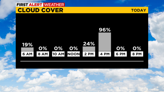
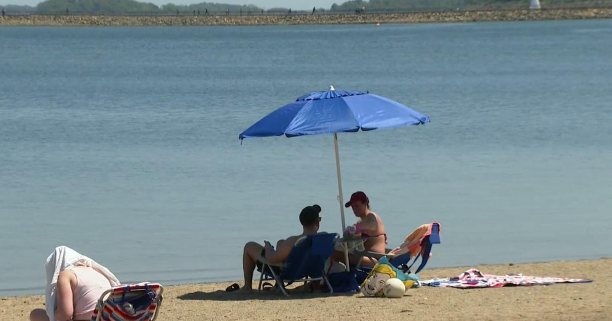
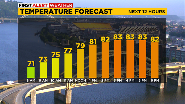
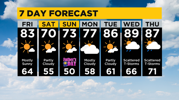
In Pittsburgh, we don't see too many sunny days but today looks to be one of the sunniest of the year. Highs will be down from yesterday's 91°. I have us hitting 83° for the high with temperatures near 80 at noon.
It will be fairly windy with afternoon wind speeds nearing 20mph.
A secondary blast of cool air arrives around 3 a.m. on Saturday morning, reinforcing the cool air already in place. Saturday will be notably cooler with highs struggling to get back to the 70s.
I have Sunday's high hitting the low 70s. Humidity levels will be extremely low.
Stay up to date with the KDKA Mobile App – which you can download here!