Pittsburgh Weather: Snow Squall Warning Issued, 1-3 Inches Expected Across Region
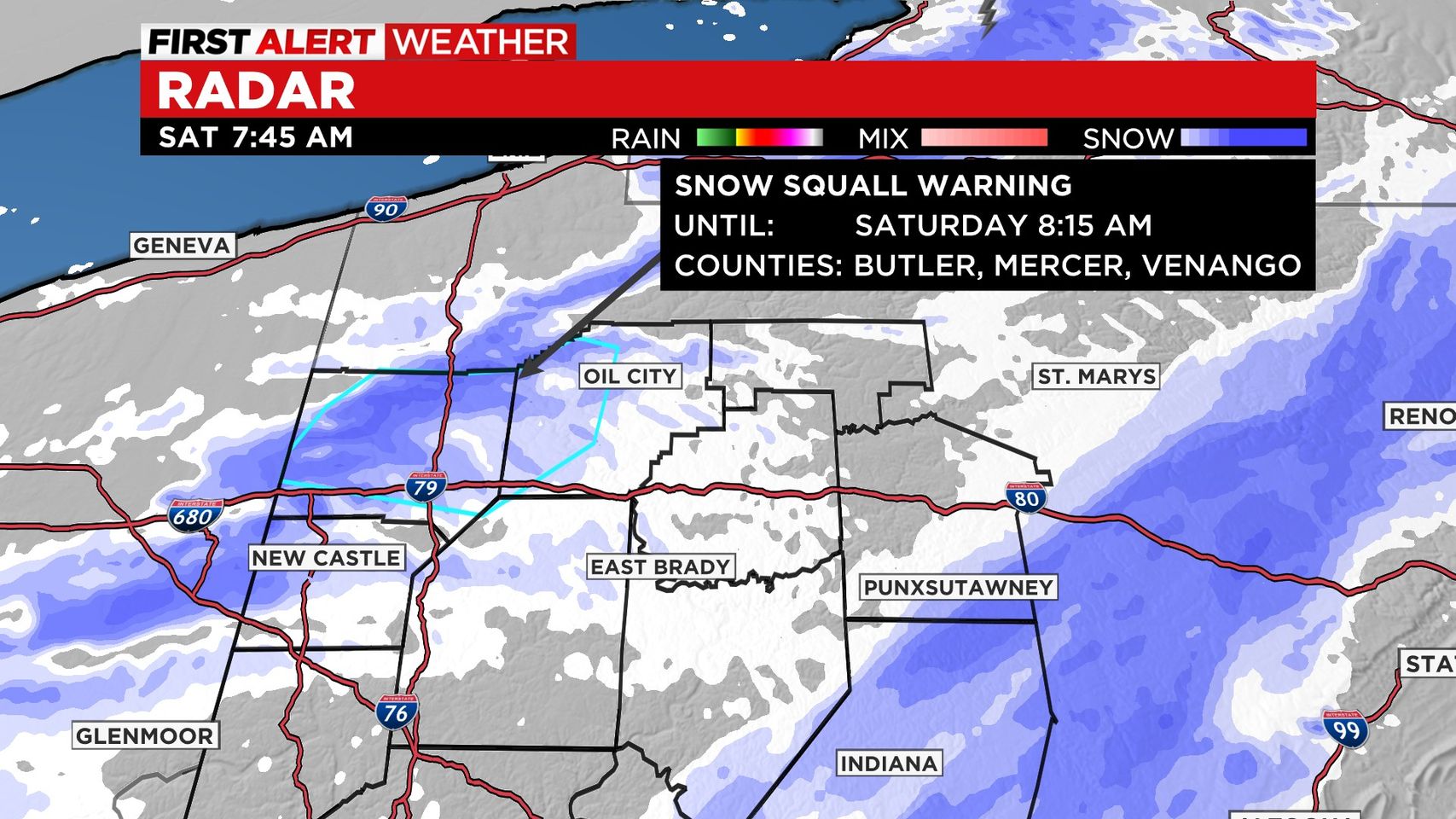
PITTSBURGH (KDKA) -- The National Weather Service has issued a snow squall warning effective immediately for the region.
It will stay in effect until 8:45 a.m. for east-central Mercer County, Venango County, northeastern Butler County, northwestern Armstrong County and northwestern Clarion County, according to NWS Pittsburgh.
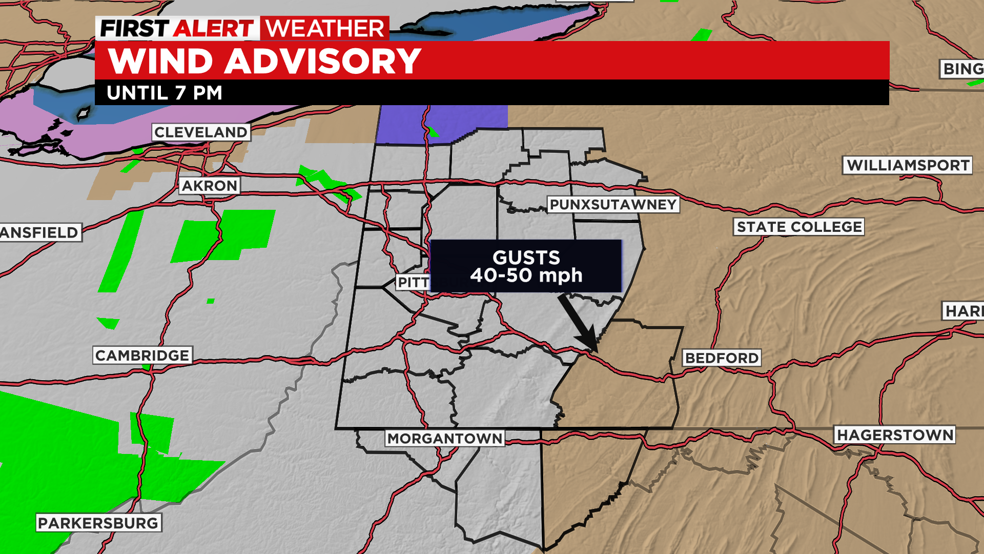
FIRST ALERT: Snow Squall this morning will leave 1-3" across the region. Highest accumulation will be in the Laurels but it'll be within a 2 hour window leaving whiteout conditions and slick roads. Wind gusts 40-50 mph this afternoon.
Aware: Cold night and Sunday morning so watch for icy spots.
WEATHER LINKS
Current Conditions | School Delays & Closings | Local Radar | Weather App | Photos
The snow arrives north around 6:00 a.m. and will end around 11:00 a.m. for the ridges.
The snow squall will move in quickly, causing problems on the roads.
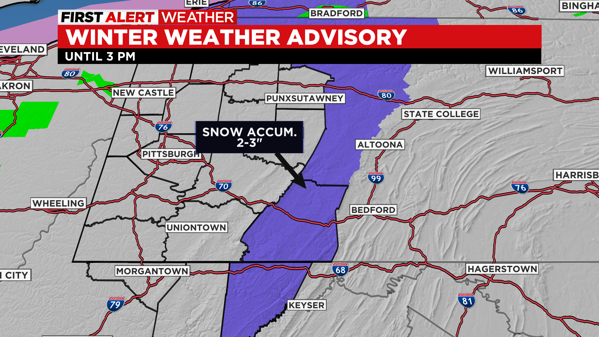
There is a Winter Weather Advisory for the Laurels until 3 p.m. and a Wind Advisory through this evening there as well.
The second part of the day will be dry and breezy with temperatures in the upper 20s and wind chills in the teens and even single digits for a few places.
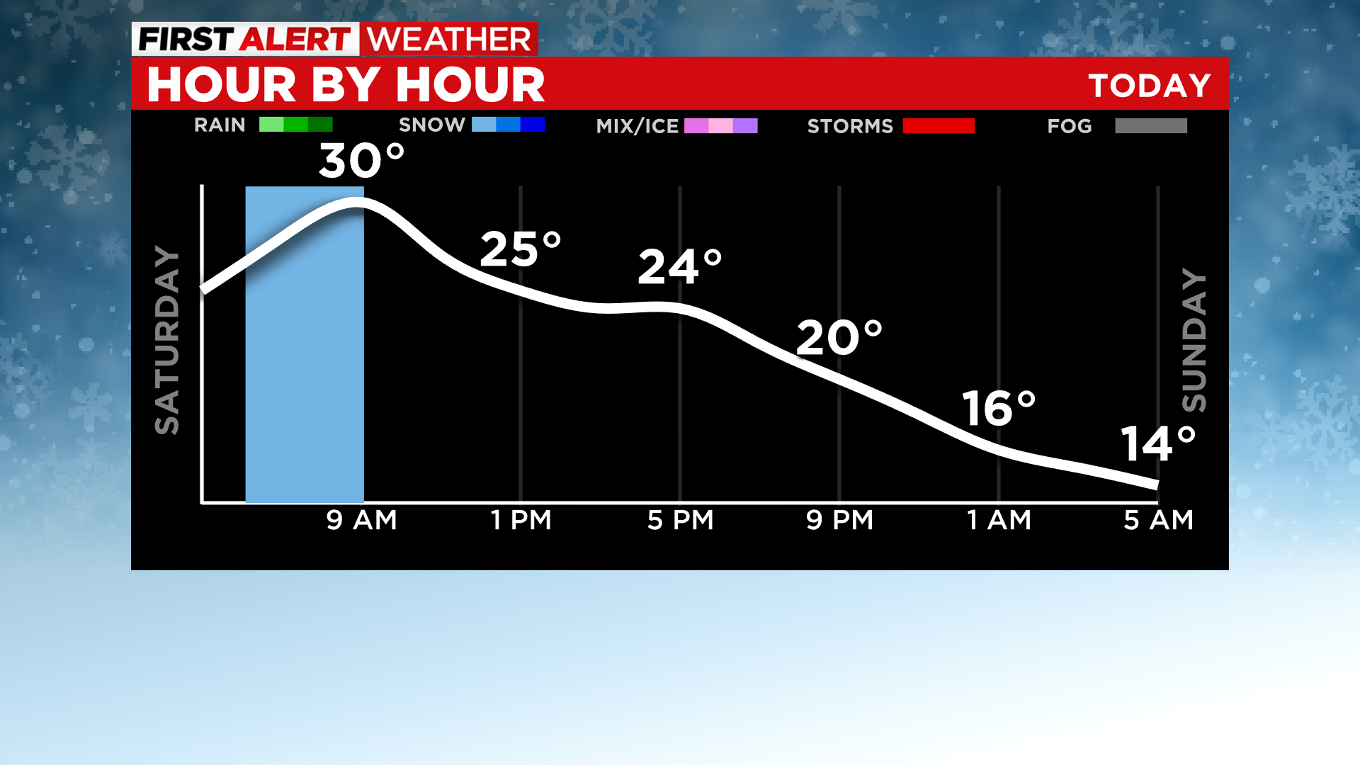
Overnight will be mostly clear and lows drop down to the teens so bring your pets inside.
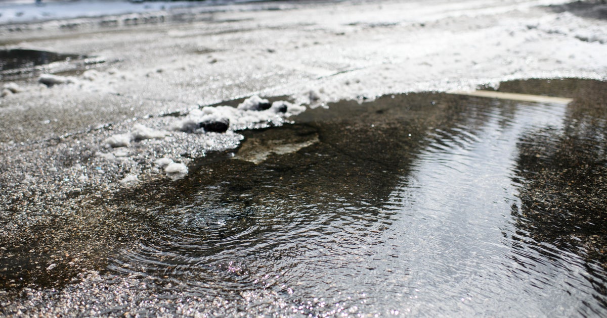
There's a Flood Advisory for the Ohio River through tomorrow afternoon which is leaving roads closed Downtown.
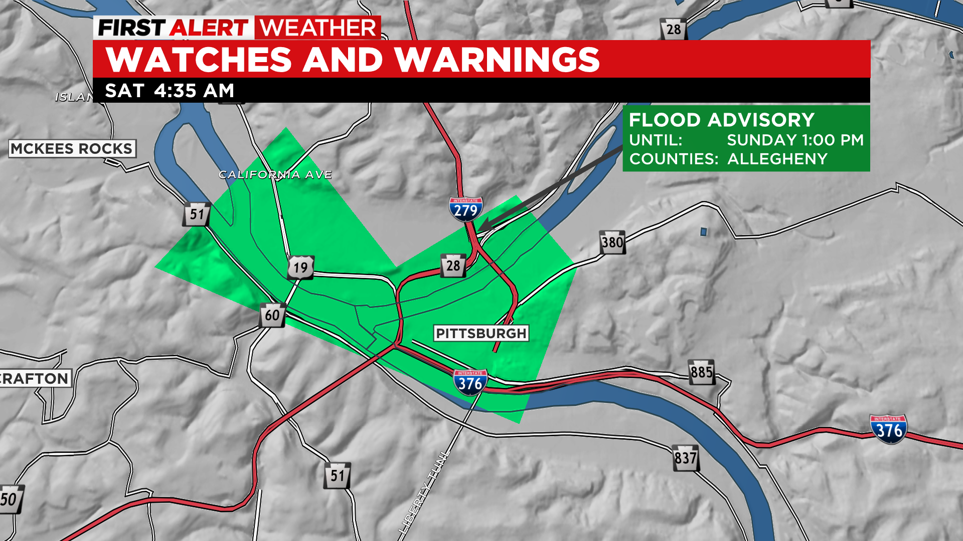
At 4:15 this morning, the river was at 22.93 feet and since then has receded to 22.6 feet and will continue to fall through the morning.
Sunday highs get back to the mid 40s with sunshine and it gets even better on Monday with highs in the 50s and possibly even 60 for some!
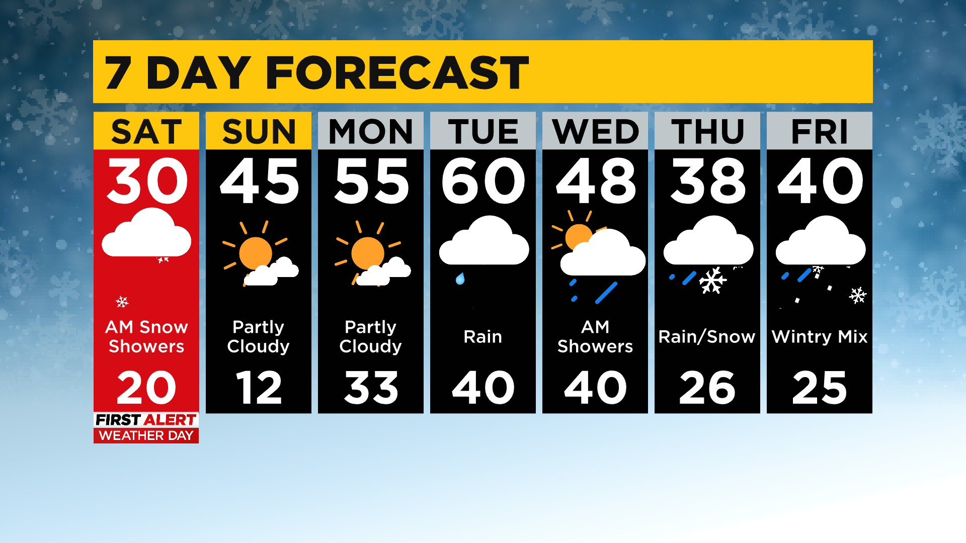
The next round of wet weather arrives Tuesday, and highs will be back around 60.
Wednesday dries out and mild weather sticks around with highs in the 50s before a chance for snow showers arrive Thursday which could potentially be a First Alert Day!