Map shows how much snow Pittsburgh could get this weekend from winter storm
A winter storm is heading for Pittsburgh, and it could dump at least 8 inches on most areas.
A winter storm warning is in effect for the entire Pittsburgh area from 7 p.m. Saturday until noon on Monday. Most of the nation east of the Rockies to the East Coast will be impacted by this storm system in some form or fashion.
Since 2000, the Pittsburgh area has seen only two winter storms with more than 12 inches of snow. This weekend's storm could be the third.
How much snow will Pittsburgh get?
Total snowfall amounts, as expected, have increased with this storm system. A broad zone from roughly between the I-70 and I-80 corridors, including the Pittsburgh metro, is likely to receive upwards of 10-16" with locally higher amounts.
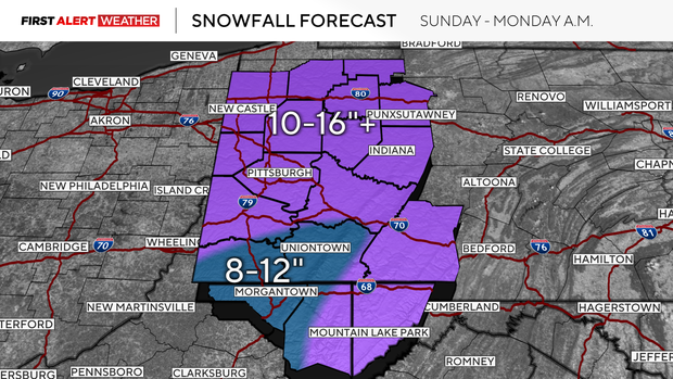
Near and south of I-70 to I-68 is where some sleet may mix in, which will result in slightly lower amounts, but still a healthy 8-12".
What time will it snow?
Light snow will begin late Saturday evening between 7 p.m. to 10 p.m., first in the southern counties and then gradually spread northeast through the overnight into the morning hours of Sunday.
The heaviest snowfall rates will likely begin after 7 a.m. Sunday and continue through 10 p.m. Sunday evening.
As a nose of warmer air intrudes in the lower-middle levels of the atmosphere, this may result in some sleet briefly mixing into our southern counties, especially areas south of I-70.
While the heavy portion of this system will wrap up Sunday night into Monday morning, lingering snow showers and gusty winds are expected to continue most of the day. This will lead to blowing snow and reduced visibility, especially in open areas with fewer trees.
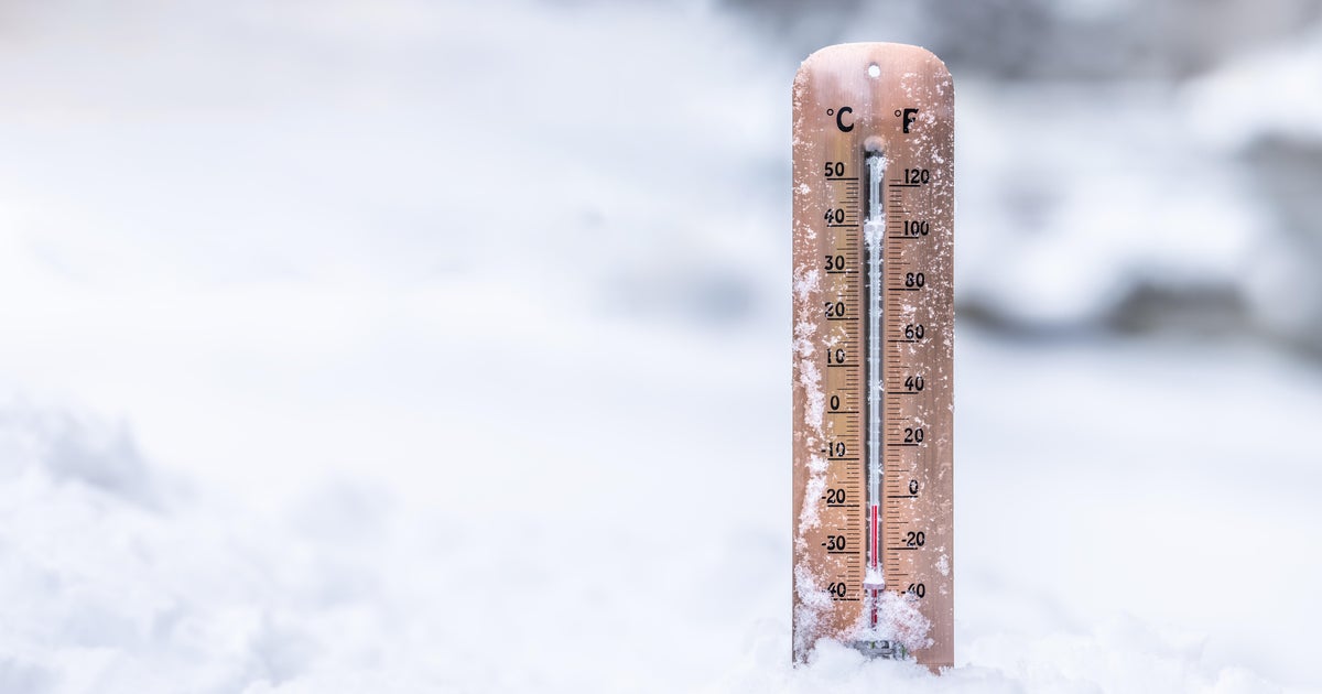
How cold will it be?
An arctic cold front is expected to arrive Friday morning and move across our area between 7 a.m. to 5 p.m. This means high temperatures on Friday will be reached early in the day, then steadily drop through the afternoon. Morning highs will be in the low to mid-20s with evening lows in the single digits.
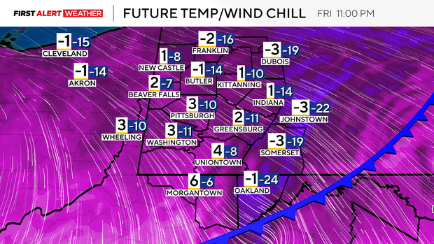
Temperatures on Saturday morning will likely range from a few degrees below zero to a few degrees above zero. Winds will be fairly light with high pressure in place, but even the lightest breeze will still be enough to drop wind chills as low as -10 degrees in spots.
Don't expect much of a temperature climb on Saturday, with most areas reaching the upper single digits to low teens.
Consider altering travel plans
Travel will be very difficult area-wide with this system and snowfall rates on Sunday could be too heavy at times for plows and road crews to keep up.
It is strongly advised that you alter your travel plans during the height of this system. Isolated power outages cannot be ruled out as well.
Waves of cold air are likely to continue moving into the Pittsburgh area through much of next week with more mornings of hazardous wind chills, especially Tuesday morning of next week.
Shapiro signs disaster emergency
Pennsylvania Gov. Josh Shapiro signed a disaster emergency proclamation on Friday ahead of this weekend's major storm. He is urging residents to "Stay off the roads if you can, be safe, and follow instructions from PEMA and your local authorities."
The disaster declartations allows Pennsylvania to make resources available to prepare for and support response efforts.