A warmer weather pattern moves into the Pittsburgh area for the week
The theme for this week when it comes to the weather forecast for the Pittsburgh area is 'warming up'.
Any Alert Days Ahead? Nope
Aware: As of yesterday evening, the NWS reports around 2 inches of snow on the ground in Moon, where their offices are.
Highs today will be in the mid to low 40s. It'll be the warmest weather since the 29th of last month.
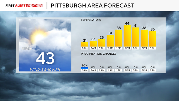
Highs may hit the 50s tomorrow, I have Pittsburgh's Tuesday high at 49°. I also have us hitting the 60s on Friday and Saturday for highs.
With that amount of warming, most snow should be able to melt off before our next cold stretch arrives next Sunday. As of this morning, the official snow depth for Pittsburgh is 2". Snow depths of less than an inch should be expected by the end of tomorrow for most places south of I-80.
With the warmer weather in place, snow shouldn't be much of an issue through Saturday. We do have a couple of chances for rain, though, including the next chance arriving on Tuesday evening with rain sticking around through Wednesday morning. We may have a burst of snow along and north of I-80 on Wednesday morning as the core of the low-pressure center passes by. I don't expect conditions that will allow for anything more than a dusting of snow as the system passes through.
Our best chance for rain this week comes Friday afternoon through Saturday, with rain totals between a half inch to a full inch expected across Western Pennsylvania. We may hear a couple of rumbles as a warm front sweeps through late on Friday.
As the cold front on Saturday sweeps through, expect a rapid cool down to occur with temperatures dipping from around 60 degrees to around 30 degrees by the end of Sunday.
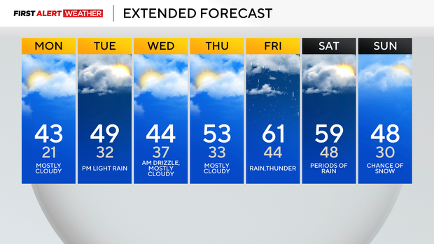
It'll be windy with snow showers around throughout the day. A colder weather pattern will be in place to start next week.
WEATHER LINKS:
Current Conditions | School Closings & Delays | Submit Your Weather Photos