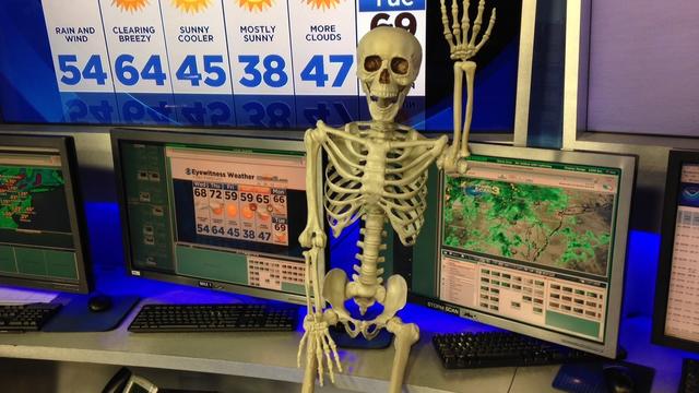
WEATHER: Halloween Forecast Will Be A Treat
Wednesday's storm system will be long gone and dry and cooler weather will return for Halloween.
Watch CBS News
Wednesday's storm system will be long gone and dry and cooler weather will return for Halloween.
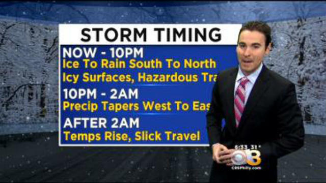
Even though the precipitation will end, untreated surfaces will remain icy overnight into Monday morning.
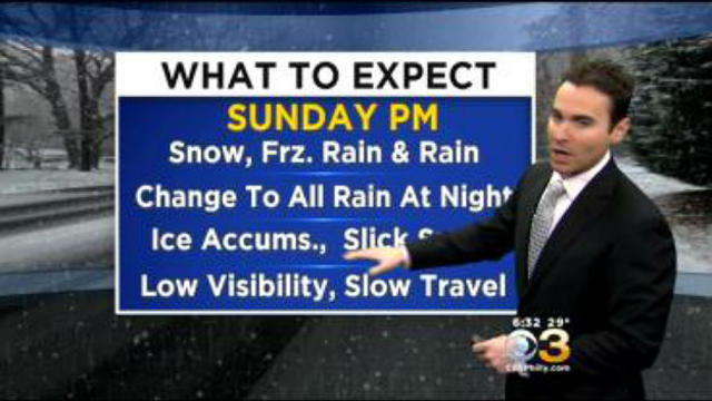
Another weekend storm will impact the Delaware Valley on Sunday afternoon and night.
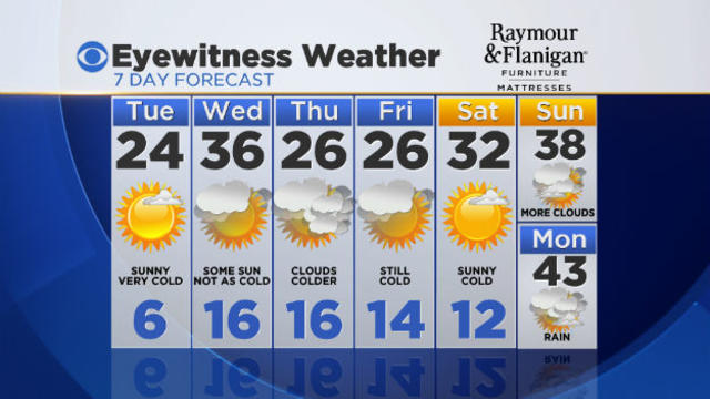
Another arctic cold front moved through the Delaware Valley this morning keeping afternoon temperatures holding in the teens and 20s.
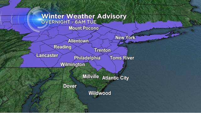
Winter storm warnings and winter weather advisories remain in effect.
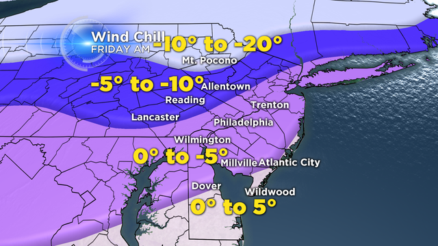
A wind chill advisory remains in effect into Monday morning.
If you are a winter weather fan, you will love the forecast over the next several days and get ready for a cold Valentine's Day weekend.
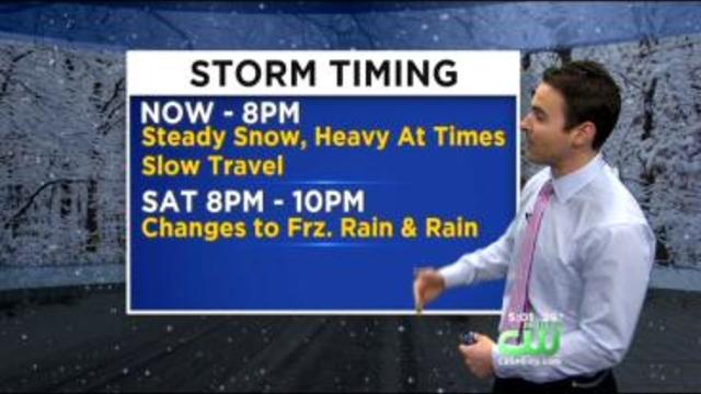
Expect rain showers to arrive overnight but change over to freezing rain, then light snow in the N&W suburbs from North to South on Monday, as colder temperatures return.
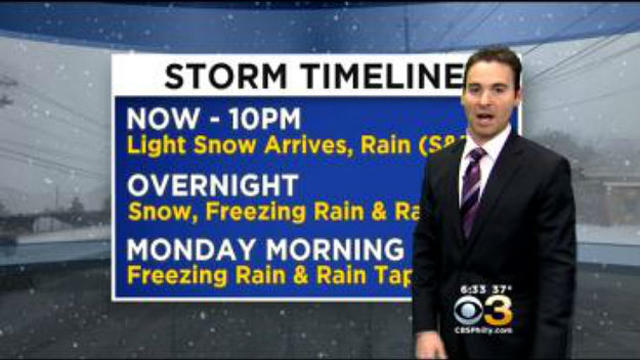
Areas of light snow will continue to move into the region and change over to freezing rain and rain from south to north overnight.
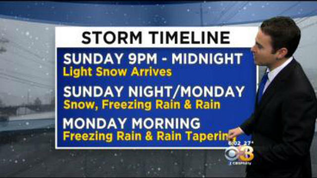
With the recent arctic air mass in place, freezing rain will be an issue for parts of the area.
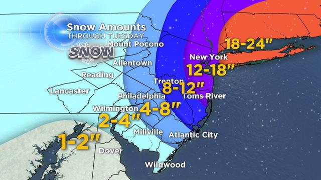
The Nor'easter will continue to intensify off the east coast and track northward tonight.

Winter storm warnings will go into effect at noon on Monday.
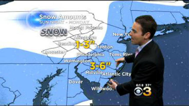
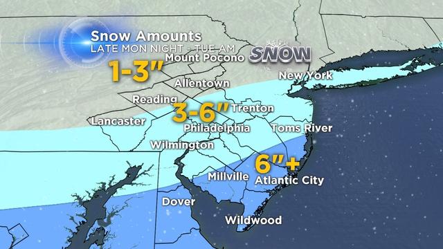
After Saturday's storm we catch a brief break for the rest of the weekend, before another snowstorm arrives late Sunday night.
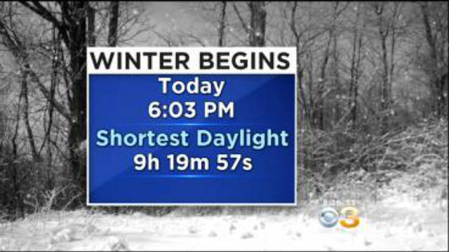
Today is the first day of Astronomical Winter as the Winter Solstice arrived at 6:03pm.
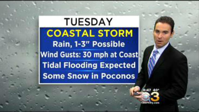
The heaviest rain will fall during the morning into early afternoon on Tuesday
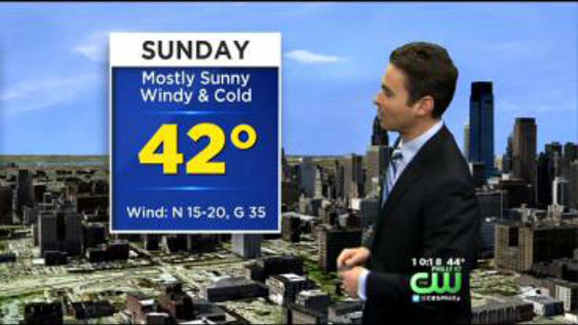
After picking up around 1" of rain on Saturday, the Delaware Valley will dry out for the second half of the weekend.
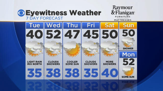
After finishing the month of November almost 2.5 degrees below average, December starts off well above average, with high temperatures in the 60s and even some 70s.
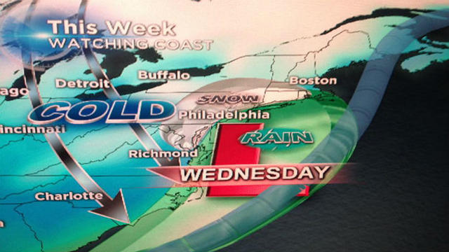
It looks like a rain changing to snow event for the region on Wednesday and Wednesday night.
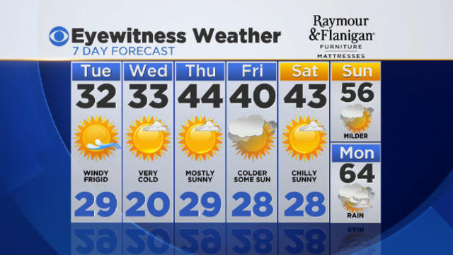
As Arctic air spills into the Delaware Valley overnight, skies will clear. Sustained winds, 15-20 miles-an-hour will continue, and morning wind chills be drop into the teens. The clear skies will provide a good view of the annual Leonid Meteor Shower. Best viewing right before sunrise!
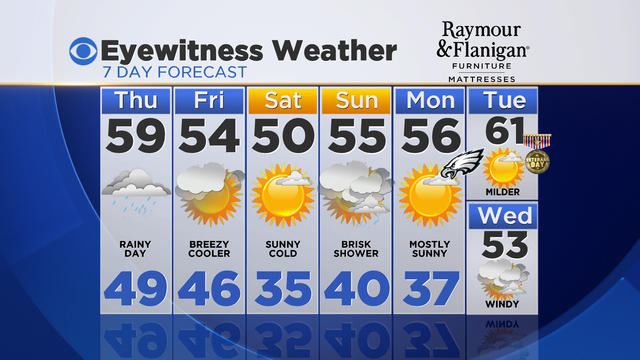
It was another mild day today across the Delaware Valley with high temperatures well above average in the 60s. However, Philadelphia was the warm spot reaching 72 degrees.
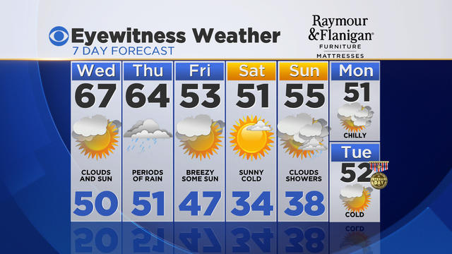
So far this year, October is our warmest month above average by 2.4 degrees. Then, November started off well below average, but now a warm air mass has returned to the region.
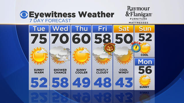
A brief change in the weather pattern will allow temperatures to surge well above average on Tuesday and Wednesday
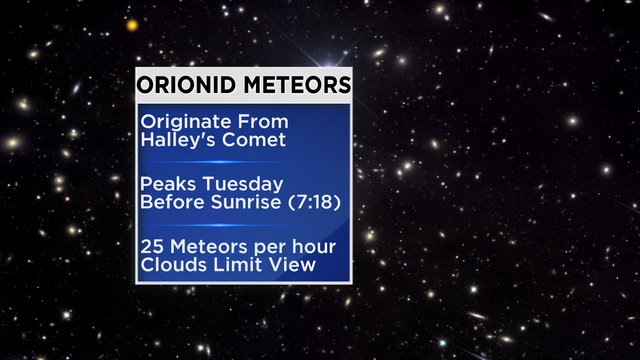
Clouds will be on the increase tonight ahead of the next storm system. The clouds will keep temperatures milder tonight with a low around 50 degrees.
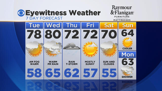
It was a cool start to the week as clouds and a few showers kept temperatures below average in the 60s today. A warm front will then push through the region tomorrow, brining in a warmer and more humid air mass.
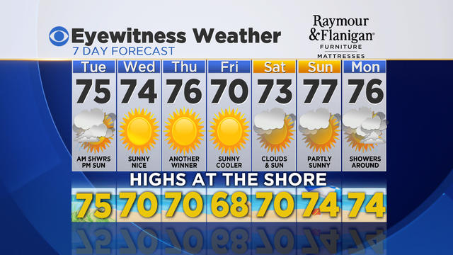
The last full week of Summer will be feeling more like Fall as a cool and quiet weather pattern remains in place for most of the week.